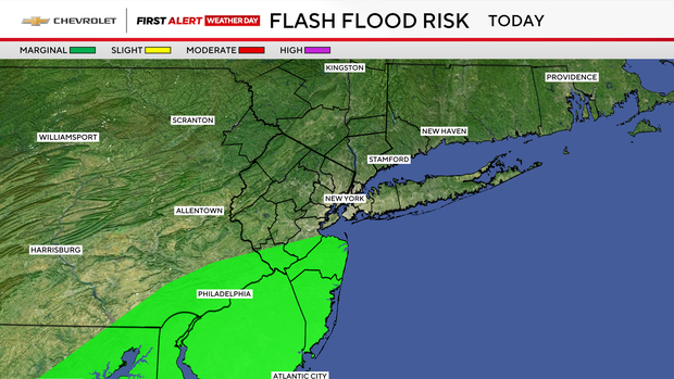
Rounds of rain expected in parts of the Tri-State Area today

Grab the umbrella before you leave the house Wednesday, because rounds of rain are possible off and on throughout the day.
A coastal low-pressure system is near North Carolina and Virginia and will make its way near the Tri-State throughout Wednesday and into Wednesday night.
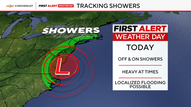
The First Alert Weather Team has issued a First Alert Weather Day for Wednesday.
It won't rain sunup to sundown, but we will have rounds of rain and some isolated downpours.
This will be a day that you might come out of the subway and have a downpour happening, so make sure you have the umbrella with you throughout the day.
With more cloud cover in place and rounds of rain, high temps will struggle to warm to the upper 60s to 70s in the city. We need the rain since we have been dry for the past eight days. Some forecast models are forecasting nearly an one inch of rain.
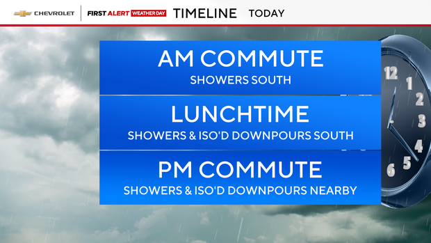
The evening commute also looks to have some heavy rain between 4 p.m. and 8 p.m. around the city so plan for a longer commute.
Not all of us will see the pockets of heavy rain but we will see some isolated rumbles of thunder and, at times, some heavier downpours.
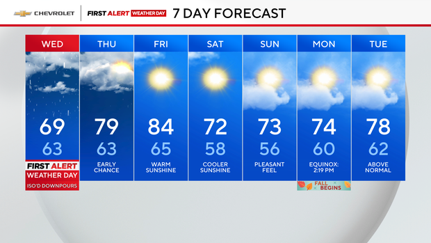
By Thursday morning, the low-pressure center will begin to pull away from the area and we will see clouds slowly clear. Some leftover rain can't be ruled out before the clearing in the afternoon.
Friday looks warmer and drier with highs warming into the lower 80s. This is ahead of the next cold front on the way Friday night, which will usher in a great fall weekend!