Freezing temperatures here to stay with dangerously cold mornings
Although the snowstorm has passed, the freezing temperatures will linger for the rest of the week. The region is bracing for some of the coldest conditions of the season.
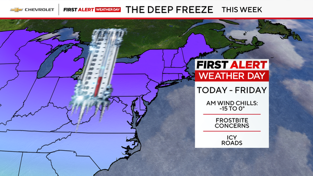
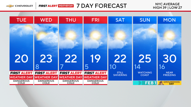
First Alert Weather Days are in effect through Friday due to dangerously cold mornings. Morning wind chills will be especially harsh, ranging from a bitter -20 to 0 degrees, posing risks for frostbite and hypothermia.
Residents are urged to limit time outdoors, bundle up in layers and check on vulnerable neighbors and pets.
This arctic chill marks the beginning of a prolonged period of unseasonably cold air, expected to grip the region through the weekend.
Forecasters warn that temperatures will run 10 to 20 degrees below normal, offering little relief even during the warmest part of the day. In fact, afternoon highs are forecast to stay below freezing, making this an unusually persistent cold spell for late January.
Residents should also beware of hazardous road and sidewalk conditions. As temperatures dip, the concern is slush and snow could freeze, making it slippery.
Cold Weather Advisories for parts of Tri-State Area
Most of New Jersey is under a Cold Weather Advisory until 10 a.m. Wednesday. The feels like temperatures range from -10 to -5 degrees.
New York City and Nassau County will be under an advisory starting Tuesday night until Wednesday morning for feels like temperatures below 0.
Throughout this period, wind chills are expected to plunge between -10 and -5 degrees, with even colder readings in outlying areas.
Frigid, blustery Tuesday with no relief in sight
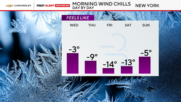
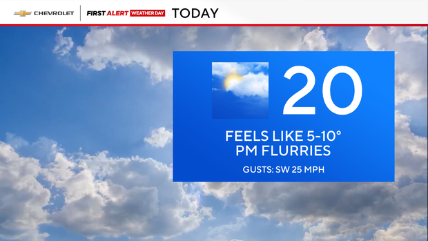
Tuesday starts off frigid and blustery, with wind chills between -10 and 5 degrees.
Light flurries may drift through by the afternoon, but the dominant theme remains the cold, with wind chill values only 5 to 10 degrees.
Tonight offers no reprieve, as wind chills again dip to -10 to 0 degrees.
The pattern continues through midweek. Wednesday stays very cold, with feels-like temperatures in the 10-to-15-degree range.
Thursday will feel more like 5 to 10 degrees throughout the day.
Watching for another chance of snow
The weather team is watching for any storms that could impact the area as the cold settles in.
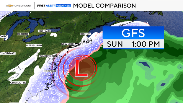
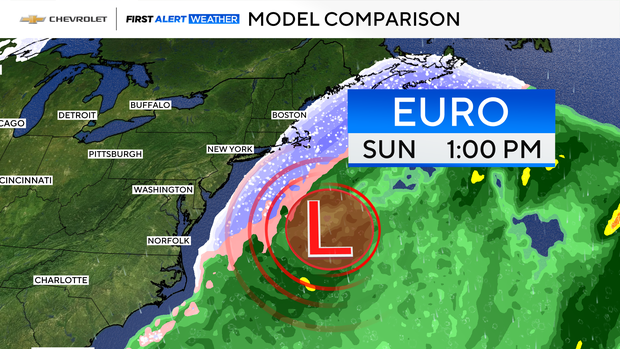
The GFS, or American, model shows a potential system on Sunday brushing the area. The European model is showing the system a little more offshore. Both models show a very small amount of snow with .1 inches.
The system is still days away, so the forecast will continue to change and be fine-tuned.