Winter warm up headed to Tri-State Area. Here's what to expect, and when.
Tuesday morning felt a little milder than Monday, but changes were on tap heading into the afternoon.

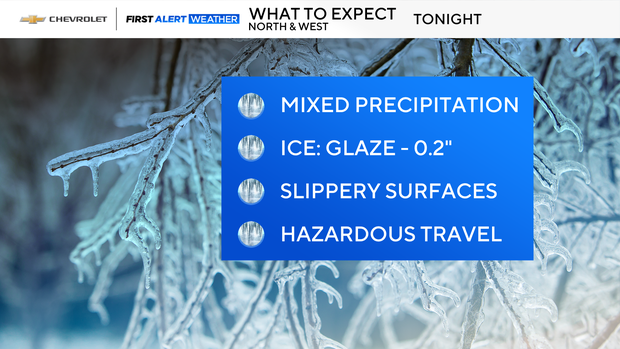
Showers will start to develop, especially north and west of the city, and that's where things could get slippery. Highs will reach around 40 degrees, so it's not bitter cold, but don't let that fool you -- freezing rain is expected across our northwest suburbs.
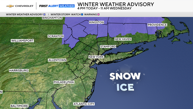
In fact, a Winter Weather Advisory is in effect from 4 p.m. Tuesday through 11 a.m. Wednesday for Sullivan, Ulster, and Dutchess Counties, where a mix of snow, sleet, and freezing rain could make travel hazardous. If you're headed that way, plan extra time and use caution. Click here to check the latest weather advisories, watches and warnings.
Tuesday night, showers linger with icy spots continuing north and west. Wednesday brings improvement: leftover morning showers give way to breezy, milder conditions with highs in the upper 40s.
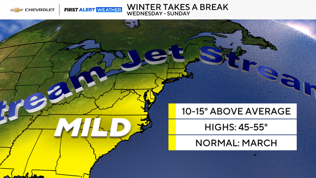
Looking ahead to Thursday, expect sunshine mixed with a few clouds and highs again in the upper 40s.
So, while Tuesday may have some bumps, the trend is toward milder, more pleasant weather.