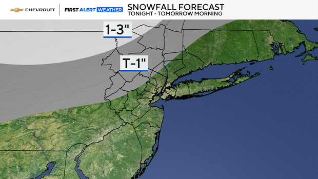
Parts of the Tri-State Area may see some snow Wednesday. Here's what to expect, and when.
Wednesday night, showers linger, and areas well north and west may pick up some light snow. Accumulations will be minimal—around an inch at most—but it's a sign of what's coming.
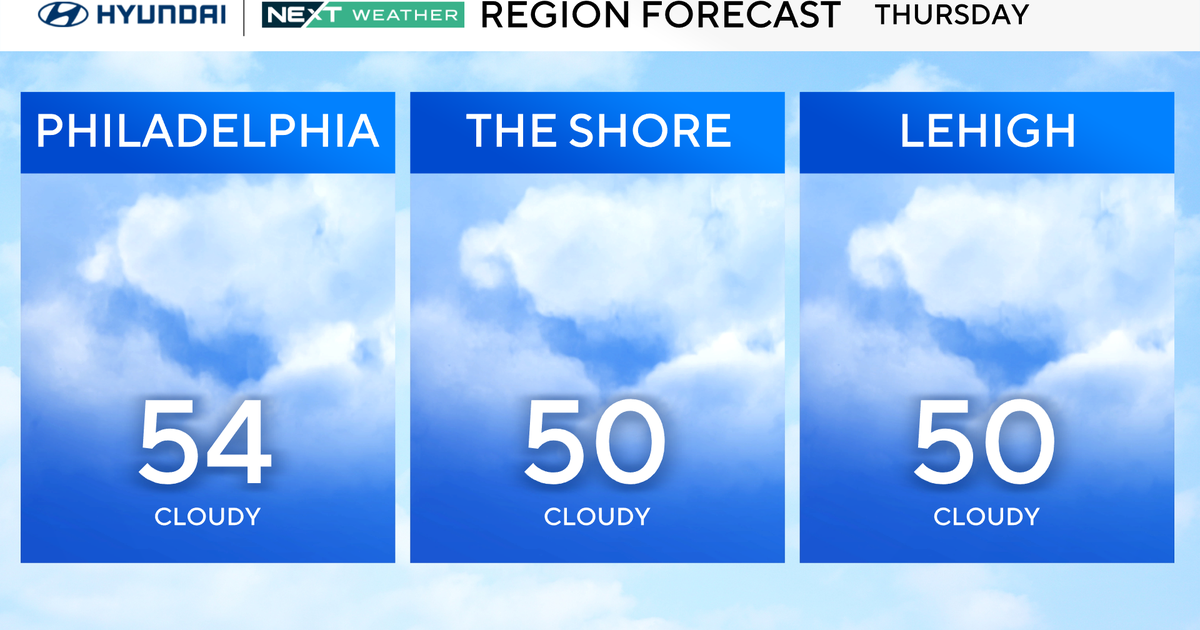
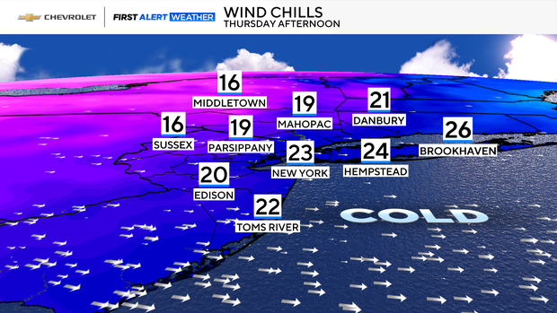
Thursday morning brings flurries and a noticeable chill. Breezy conditions will make it feel like the 30s and 20s. By afternoon, brace yourself: blustery winds will drag those feels like temperatures down into the 20s and even teens.
Friday keeps the cold trend going, with highs in the low 30s but feeling more like the 20s.
Looking ahead to the weekend, Saturday offers a slight break—milder air returns with highs in the low 40s and a chance of rain or snow showers. Sunday flips the script again, turning colder with highs in the 30s.
Bottom line: enjoy Wednesday's mild stretch because winter is knocking on the door.