Blizzard warning in NYC and Tri-State Area with snowstorm primed to bury region Sunday-Monday


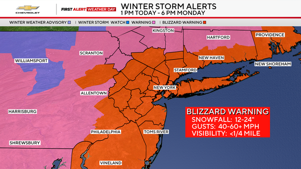
A Blizzard Warning has been issued for New York City and along the Tri-State Area coast, including all of Long Island, as a major snowstorm appears primed to bury the region. Winter Storm Warnings are in place further inland.
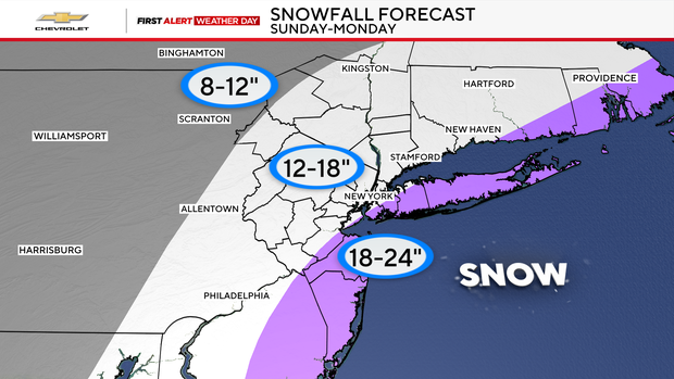
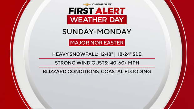
It's expected to start snowing Sunday in New York, New Jersey and Connecticut, lasting through Monday afternoon. The highest snow totals are expected south and east of NYC, with up to 24 inches possible on Long Island and along the Jersey Shore.
What the forecast shows
After what was a remarkably nice Saturday featuring some sun and milder temperatures reaching the mid-to-upper 40s, colder air will rush back in on Sunday in advance of the next storm.
The general consensus is south and east of New York City could get 18-24 inches, while points north and west could get 12-18 inches. The snowfall will be heavy at times with blizzard conditions featuring winds in excess of 60 mph possible.
For now, it's best to plan for accumulating light to moderate snow that could begin as early as Sunday morning and becoming steadier during the day. Lingering impacts will extend into Monday morning's commute.
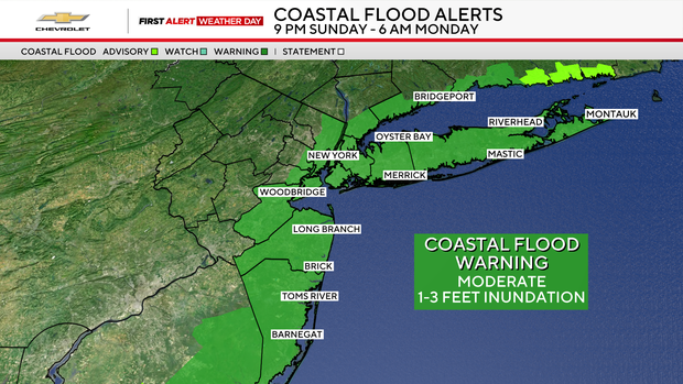
A Coastal Flood Warning has been issued for every county that has a coastline in the Tri-State Area, including all five boroughs of New York City.
Timing it out
10 p.m.-8 a.m. Monday: Snow becomes very heavy at times and may fall at rates of 2-3 inches per hour. Winds will also increase, especially at the coast, gusting 40-60+ mph at times. When combined with the weight of the heavy snow, this may lead to downed trees and powerlines. Blizzard conditions, when winds are at or above 35 mph combined with falling or blowing snow for at least three hours, could occur in many places, but especially across Long Island and at the Jersey Shore. Coastal flooding of up to 2.5 feet is likely during the hide tide cycles between Sunday night and Monday morning.
8 a.m.-1 p.m. Monday: The storm will start winding down, but snow could still fall moderately at times. It may not be completely done until the mid-to-late-afternoon hours. In general, south and east of the city is where the highest likelihood of seeing over 20 inches of snow is. Elsewhere, including in New York City, 12-18 inches, are forecasted. The strong winds will carry on through the evening hours.
Snowfall by region
New York City: Generally, 12-18 inches; 18-24 inches possible in southern portions of Staten Island, Brooklyn, and Queens
Long Island: 18-24 inches along the South Shore; 12-18 inches along the North Shore
Central Jersey and Jersey Shore: 12-18 inches inland. 18-24 inches along the coastline
Northern New Jersey, Lower Hudson Valley, and Connecticut: 12-18 inches
Upper Hudson Valley and far Northwestern New Jersey: 12-18 inches
Click here to check the latest weather watches, warnings and alerts in our area.