New York, New Jersey facing heavy snow, rain, bitter cold this weekend. Here's how the weather forecast is shaping up.

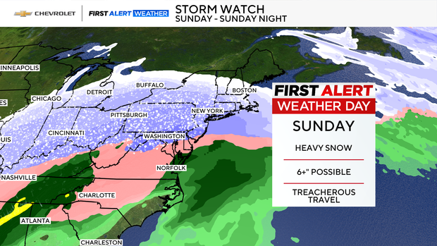
A winter storm watch has been issued for the New York and New Jersey area with significant, heavy snow expected this weekend.
A low-pressure system is forecast to develop out west but will make its way eastward, bringing snow, ice and dangerously cold temperatures to the entire Tri-State Area.
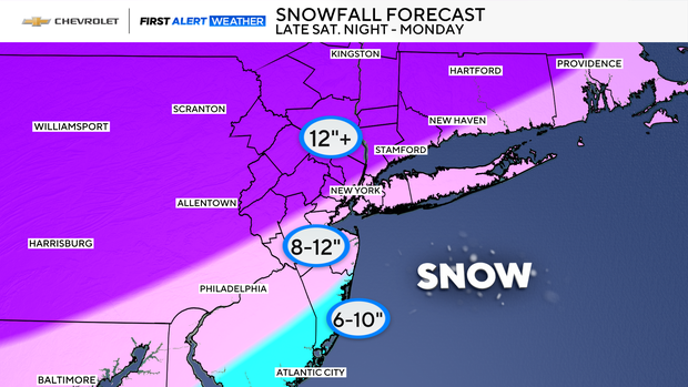
New Yorkers could see a significant amount of snow, with potential for at least 6-12 inches of accumulation from late Saturday night through Monday afternoon.
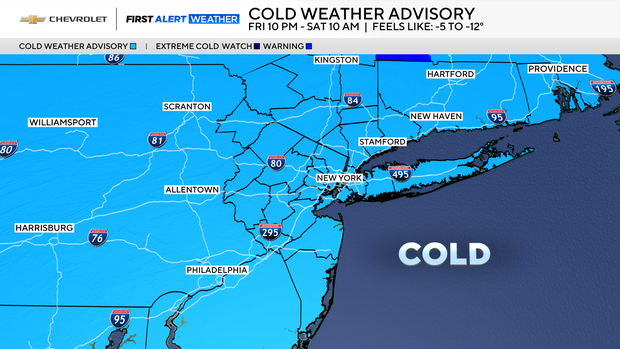
It starts as an arctic air mass settles in Friday night, locking in prolonged subfreezing temperatures through at least the middle of next week, potentially enhanced by fresh snow cover. A cold weather advisory will be effect at 10 p.m. Friday through 10 a.m. Saturday with -5 to -12 degrees possible.
Much of the Midwest is also under cold weather advisories, watches and warnings.
Snowfall outlook
Confidence is now high enough for Winter Storm Watches across the entire region, with a powerful coastal system expected to impact the area late Saturday night through Monday.
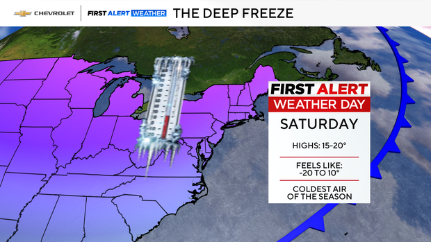
Saturday, Sunday and Monday are First Alert Weather Days due to the impact of the impending storm.
Snowfall amounts may ultimately exceed 6 inches, with the potential for widespread totals over a foot if current trends hold. The cold and snow linger into next week, with additional cold weather hazards possible Monday night into Tuesday.
The two main forecast prediction models, the European and the American, or GFS, are still showing different amounts of snow.
The GFS shows the system offshore with snow amounts totaling 19.5 inches. The European puts the system a little closer to the coast, which could cut down on snow amounts totaling 13.4 inches. Another model, the NAM, suggests snow totals could exceed 12.5 inches.
We know once the storm develops it will bring heavy snow to our area, lasting all day Sunday. We don't know yet where the heaviest snow will fall or it there will be any mixing along the coast. Both depend on the exact track of the storm.
The last time New York City got a foot or more of snow was Feb. 1, 2021.
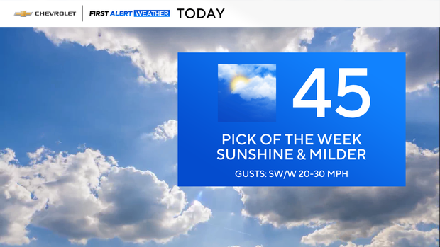
Thursday is the warmest day of the week
Thursday provided a quick break from the bitter cold to the upper 40s in New York City. At night, it was partly cloudy and mild with highs around 40.
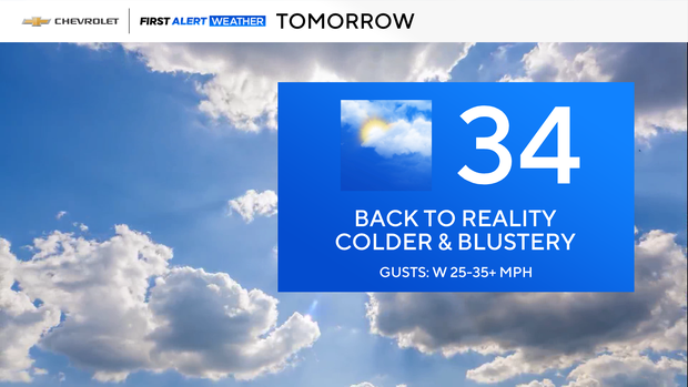
Although temperatures dip on Friday. It will be cold and blustery heading into the weekend. Highs will be in the 30s but it will feel like the 20s and teens.
Timing out the weekend storm
Saturday will be frigid with morning wind chills between –20 and 0°, and the afternoon stays in the –5 to 10° range.
All eyes are on Sunday, where it will also be very cold with wind chills in the single digits.