New York City area to see more sunshine today, with highs around 70
NYC weather today
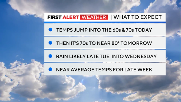
After a cool start, temperatures will rebound very nicely today as highs reach the upper 60s and low 70s under mostly sunny skies. A stray shower is possible in the afternoon hours, especially west of the city. Tonight will be the last night to catch the Northern Lights in our area and skies should cooperate.
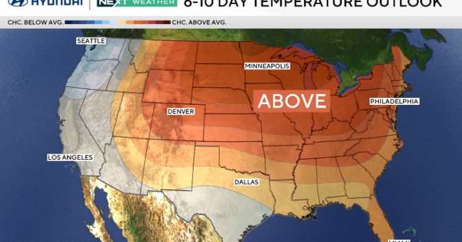
Temps warm even further by Tuesday, getting into the mid 70s to near 80. Our wettest period looks to be late Tuesday through Wednesday. During this timeframe, moderate to heavy rain is possible and many locations may see an inch or more of rainfall. Overall, temperatures will be near average for mid-May throughout the week.
NYC 7-day forecast
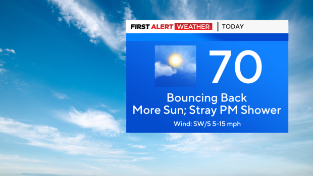
Today: Cool to start, with patchy fog, then much warmer by the afternoon. Mostly sunny, with a slight chance of showers in the evening, mainly west of the city. Highs in the upper 60s to low 70s. Cooler along the immediate coast.
Tonight: Partly cloudy. Not as cool with a low of 56 in the city, and low 50s for the suburbs.
Tuesday: Partly sunny, with showers and storms possible in the evening hours. Highs in the mid to upper 70s.
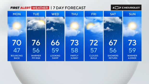
Wednesday: Steady rain and or drizzle. Rain could be heavy at times, with isolated storms possible. Cooler and more humid. Highs in the low to mid 60s.
Thursday (Pick Of The Week): Rain clears out early, then lots of sunshine comes into play. Less humid with highs in the low to mid 70s.
Friday: Bright start, with more clouds and a stray shower late. Highs in the low 70s.