Cold, wind stick around NYC this week. Tracking our next snow chance
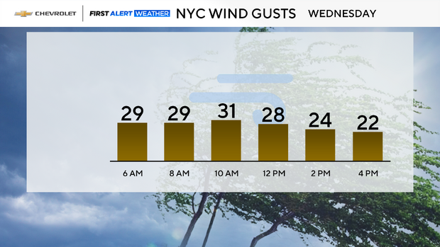
Frigid temps and blustery winds will remain in place across the Tri-State Area throughout the next several days.
Tuesday night, lows will dip back into the teens, with a few single-digit readings to the north. Winds gusting between 25-35 mph will keep the windchills in the single digits to below zero.
To start off on Wednesday, lots of sunshine will be in place, but clouds will become more prevalent by the afternoon hours. Highs won't stray too far from where they were Tuesday, only topping out in the upper 20s to lower 30s.
Snowstorm no longer looks like a concern for NYC area
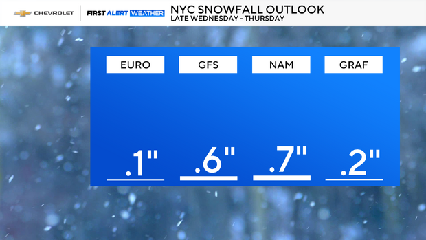
As for that potential snowstorm on Thursday that we've been tracking for days, it no longer looks like a big concern for the Tri-State region. Yes, there will be a big snowstorm out there, but it won't deliver big snow totals around here, as its track has shifted to the south and east.
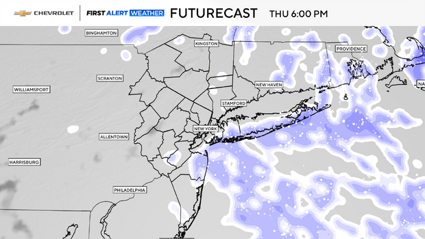
Initially, forecast models were putting out extreme snow totals, as high as 23 inches in some cases, however all of the models have now come into agreement that less than 1 inch of snow will fall across the majority of the region. The best bet of seeing a 1- to 3-inch range of snow would be for coastal areas, especially in eastern portions of Suffolk County. Whatever snow does fall on Thursday would come in the form of intermittent snow showers, which would come to an end by Thursday night.