NYC, N.J., Conn. pivot from heavy snow to bitter cold
After winters of very little snow over the last several years, the Tri-State Area finally got a snowstorm over the weekend that delivered healthy amounts.
How much snow did we get?
Before arriving in our neck of the woods, that same storm system put down heavy snowfall in a swath stretching from New Mexico to Pennsylvania. Even portions of Arkansas saw a foot of snow.
For New York City, not only did Sunday's storm bring the most snow from one storm in nearly four years, it also proved to be record breaking.
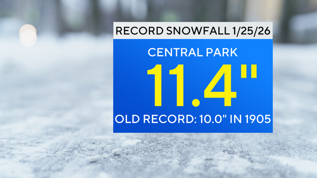
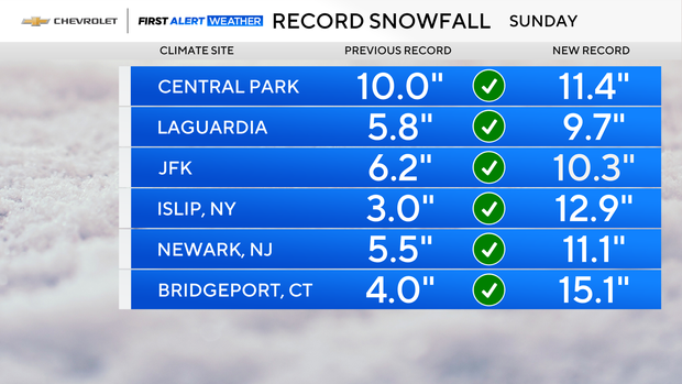
With a tally of 11.4 inches in Central Park, that was the most snow ever recorded for the date of Jan. 25. The old record was 10 inches, set in 1905.
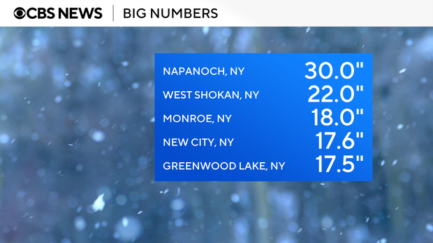
And Central Park wasn't alone. Every single one of our local climate reporting sites set new daily records for snowfall. Bridgeport, Connecticut downright shattered its record with a 15.1-inch total. Elsewhere across the region, double-digit totals were quite common, especially across northern New Jersey and the Lower Hudson Valley. Naponoch, New York, got 30 inches. West Shokan in Ulster County, got 22 inches, followed by Marbletown, with 19.6 inches. Closer to New York City, Monroe got 18 inches.
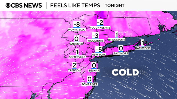
From big snow to bigger chill
The storm may now be over, but the snow on the ground is not expected melt anytime soon. A very cold pattern, featuring air straight from the Arctic Circle, has settled into the northeastern U.S., and will be here through at least early February.
Temperatures are not expected to rise above freezing during this timeframe, and we may even challenge or set a record for the longest number of days below freezing.
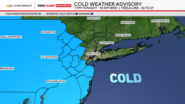
A Cold Weather Advisory goes into effect from 7 p.m. Monday night through 10 a.m. Wednesday for much of New Jersey, where it will feel like –10 to –5. And, unfortunately, that's just the beginning.
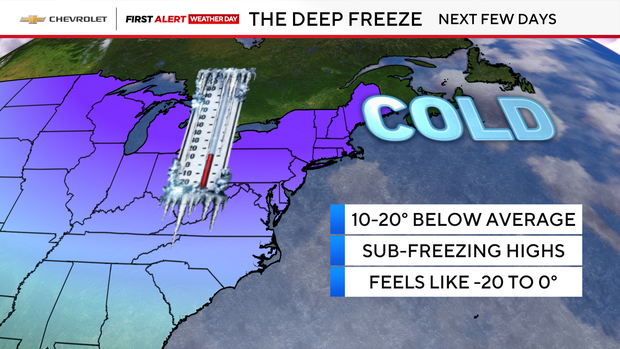
Temperatures through next weekend are expected to run a remarkable 10 to 20 degrees below normal, staying below freezing every single day. Morning wind chills will be especially harsh, ranging anywhere from –20 to 0 across the region.
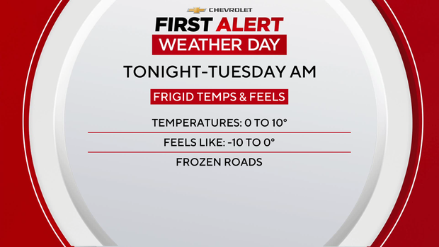
Monday night turns frigid and blustery, with wind chills again dipping to between –10 and 0.
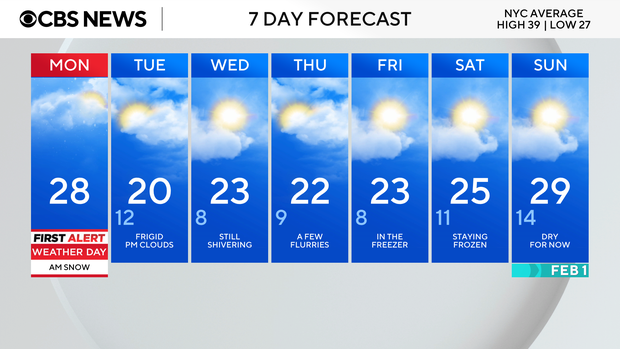
Tuesday will be another First Alert Weather Day due to dangerously cold temperatures and wind chills. In fact, we are in for First Alert Weather Days all the way through Friday due to the incredibly cold conditions. It will be the longest stretch of First Alert Weather Days to date.
Lows will range from 0 to 10 degrees, with wind chills driving them lower to -10 to 0.
A cold weather advisory is in place for most of New Jersey from 7 p.m. Monday through 10 a.m. Tuesday
And Wednesday keeps the cold going, delivering another day of wind chills in the 10–15 range.
Click here for the latest weather watches, warnings and alerts.