New York Weather: CBS2's 7/8 Wednesday Morning Forecast
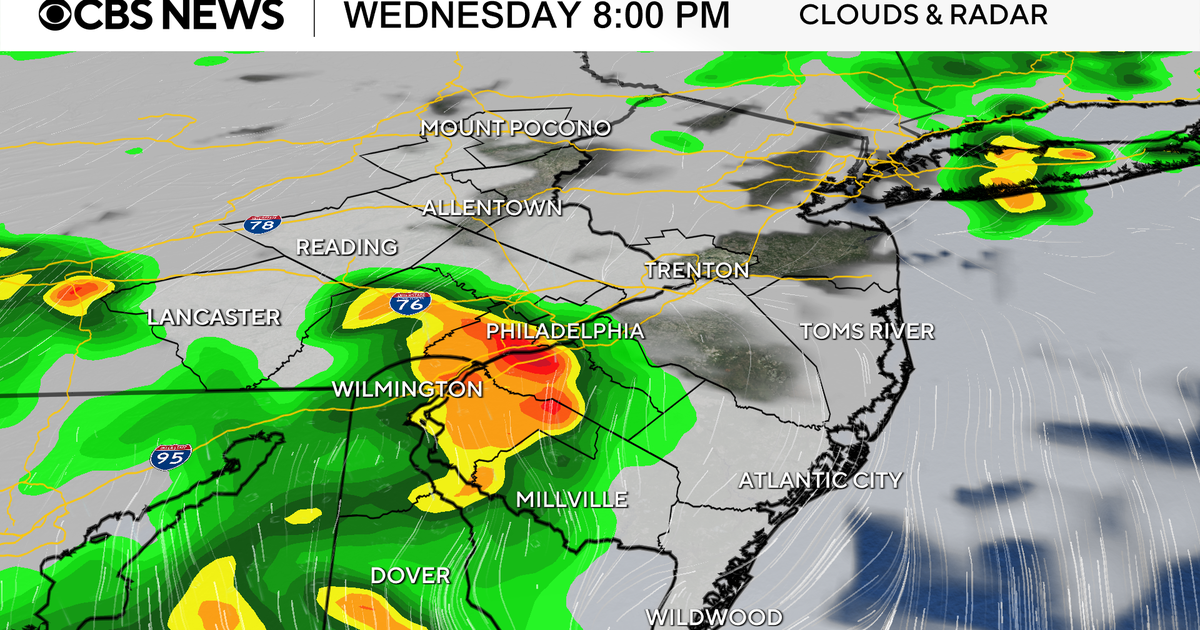
Showers/t'storms will develop mainly after 12/1 PM (starting N&W), then sag towards the boroughs through the remainder of the afternoon... the focus of the strongest activity will be mainly N&W today. Downpours seem to be the main threat with iso'd instances of damaging winds... even some hail can't be ruled out. Outside of all that, expect partly sunny to mostly cloudy skies, very humid conditions and highs in the mid 80s.
***A heat advisory will go into effect at noon for northeast NJ and remain in effect until about 6 PM tomorrow. This was issued due to the combination of heat and humidity leading to "feels like" temps in the low to mid 90s today, and mid to upper 90s tomorrow.
The shower/t'storm activity will wrap up by early to mid evening with the remainder of the night staying quiet. Expect temps to fall into the low and mid 70s.
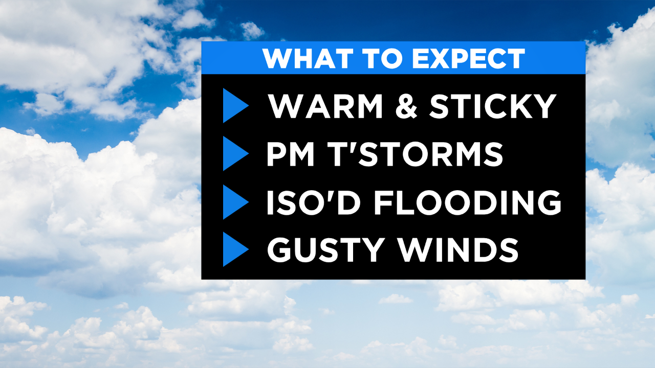
Tomorrow's a generally quiet day... just a stray shower... but it will be hot and humid. Expect feels like temps in the mid 90s in the city... mid to upper 90s in the hottest spots.
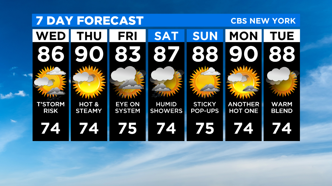
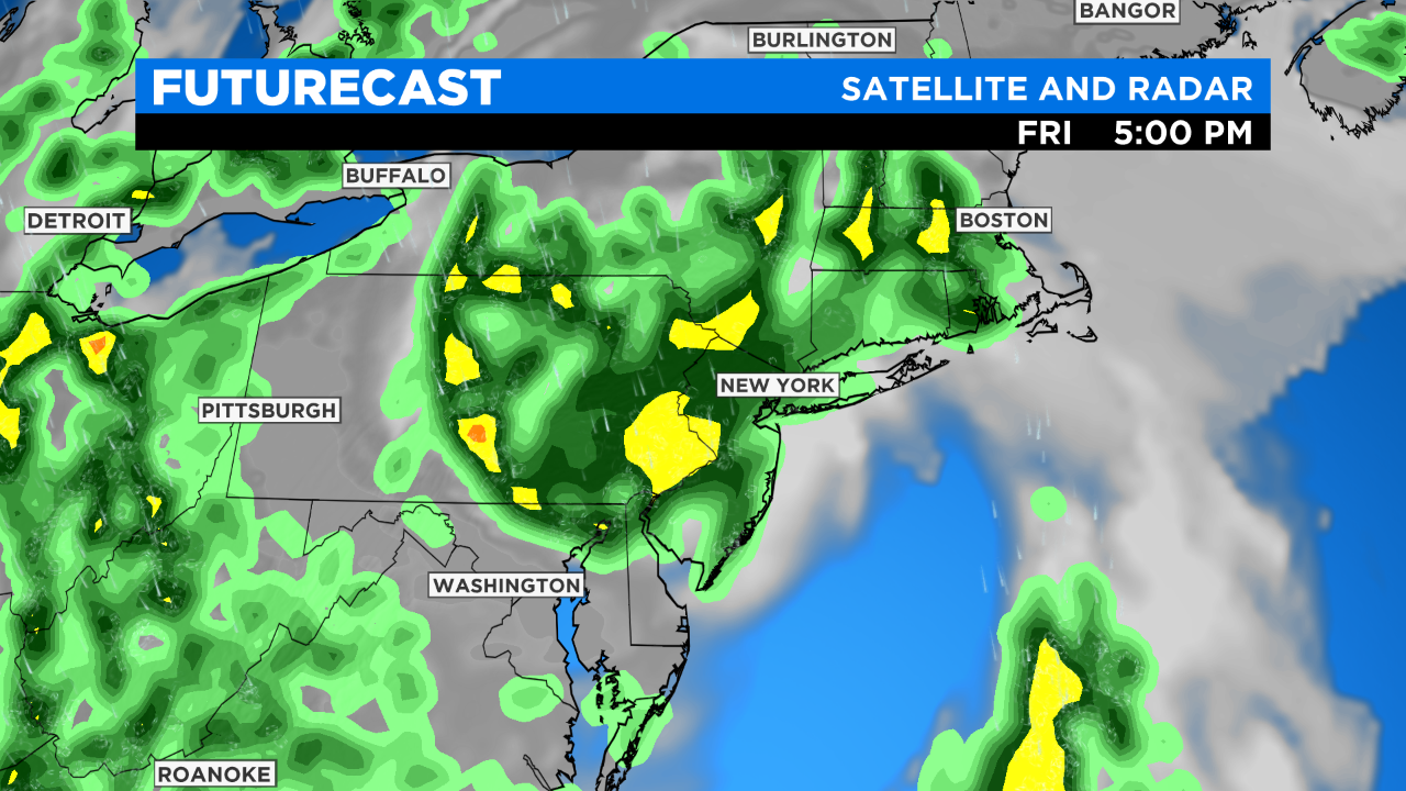
Then into Friday we'll be watching the system I mentioned yesterday. It's currently positioned over the Georgia/South Carolina boarder and has the potential to develop into a tropical system in the next day or two. Whether it does or does not, the models still want to bring a period of rain to our area, some of which may be heavy at times. We'll have more details on timing/rainfall tonight and tomorrow as the models come into better agreement.