First Alert Weather: Red Alert for winter storm bringing snow, rain and some wind our way
Red Alert
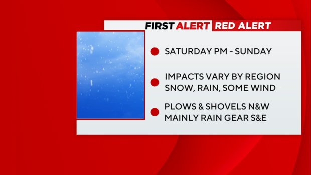
- Red Alert late Saturday into Sunday for a winter storm bringing snow, rain, some wind, and minor coastal flooding.
- Red Alert Tuesday into Wednesday for another storm brining heavy rain, strong winds, and a much larger inland flooding threat.
Storm timeline
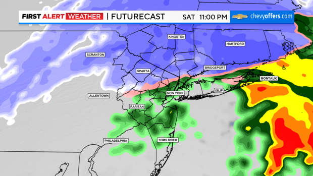
8 p.m. Saturday - 4 a.m. Sunday: Rain and snow continue (rain/snow line now into Westchester by 10-11pm). All snow north of that, all rain south. As the low passes offshore, winds can gust 35-40 mph along the coast. Far east on the Twin Forks could see some isolated gusts approach 50 mph for a brief period.
4 a.m. - 8 a.m. Sunday: Storm is pulling away taking the heaviest snow/rain with it. There is likely a break where precip becomes much more scattered. But as winds shift out of the northwest and colder air wraps around the backside, snow showers start to swing around toward sunrise.
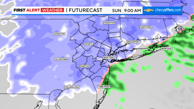
8 a.m. - 2 p.m. Sunday: The heaviest is long over, but light snow showers continue to move across. While models have come into better agreement up to this point, they're still struggling some with when the lingering snow completely exits. Overall, it will likely shut off west to east late morning into early afternoon Sunday. Not much more accumulation expected with the wraparound but could bring a coating to areas that saw more rain up to this point.
Snow totals and other impacts
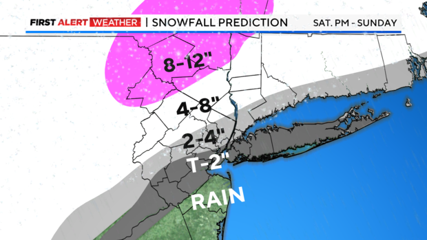
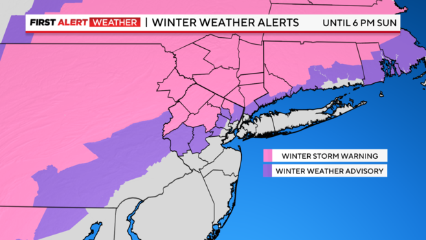
Our snow map has remained unchanged with the highest totals N&W. Head north/west of 287 and it's a snowstorm. Closer to the city and points south/east... much more wet than white. Where it's mainly rain, 1-2" possible. Some poor drainage flooding is possible, but overall, the flooding signal isn't tremendously high with this one (that changes big time Tuesday though).
Peak wind gusts of 35-40 mph are possible at the shore this evening into the overnight hours. The Twin Forks could approach 50 mph gusts for a time. Farther inland, gusts closer to 25-30 mph.
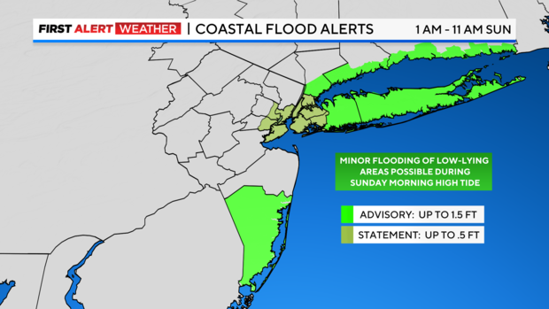
Minor coastal flooding is possible during the Sunday AM high tide cycle, mainly for Suffolk and Nassau.
Tracking Storm #2: Tuesday into Wednesday
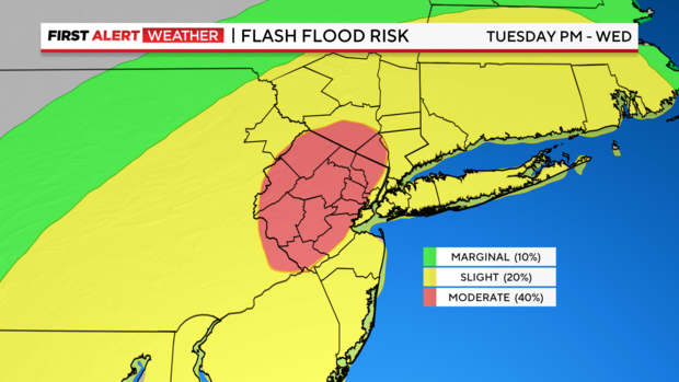
While we're rightfully focused on this weekend, we're becoming much more concerned with the system rolling in behind it. This storm will track to our west, putting us totally in the warm sector. It looks to bring heavy rain with 2-4" possible, stronger winds, and possibly more problematic coastal flooding. This one has a MUCH bigger inland/river flooding threat, especially considering spots N&W that'll have a half foot or more of snow on the ground that needs to melt. Combined, the streamflow will be very high. The National Weather Service already has a moderate flood risk out for northern NJ for Tuesday night.
Stick with the First Alert Weather team for the latest forecast and weather alerts.