First Alert Weather: Highs in the 80s will give way to evening thunderstorms
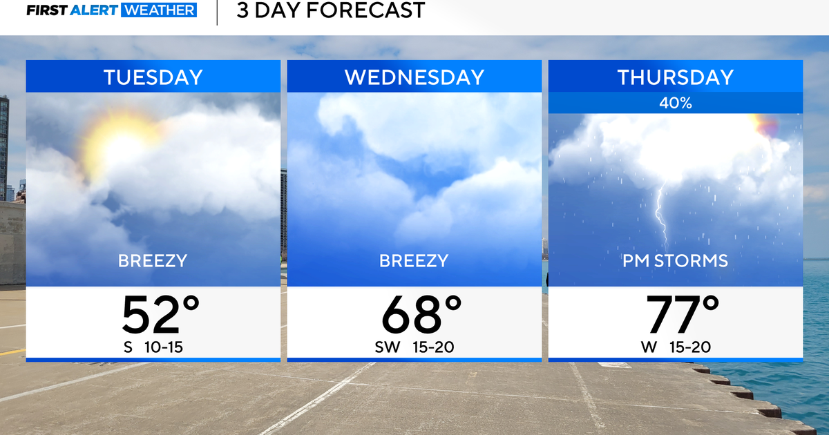
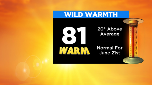
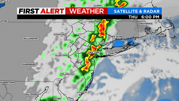
Forecast: Temperatures will be running even warmer today with highs around 80 in the city; 80s inland; and 60s/70s along the coast. Then we'll have to keep an eye on a round of showers/t'storms in the afternoon and evening that will have the potential to produce downpours (localized flooding), as well as damaging winds.
LINK: Check The Latest Forecast
Those will exit the second half of the evening with clearing expected the remainder of the night. For tomorrow, it will be mostly sunny and nearly 15 degrees cooler with highs in the 60s.
LINK: Winter Survival Guide
Looking Ahead: Some clouds return on Saturday with a chance of showers, but mainly in the afternoon and later in the day. Expect highs in the 60s.
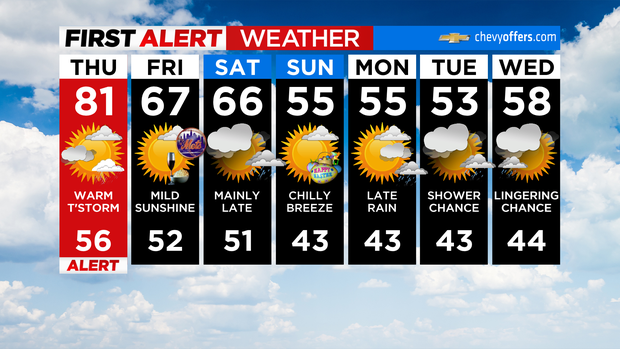
Easter will be breezy and a bit cooler with morning wind chills in the 30s/40s and highs only in the 50s.
Stick with CBS2, CBS News New York and CBSNewYork.com for the latest forecast and weather alerts.