Dangerous cold in and around NYC today makes Friday a First Alert Weather Day
If you're heading out Friday, brace yourself — it's the coldest day of the season so far.
We've issued a First Alert Weather Day because the wind chill is downright dangerous.
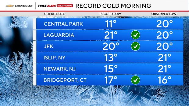
Friday morning felt like the teens and even single digits thanks to biting wind chills. So, layers are your best friend today.
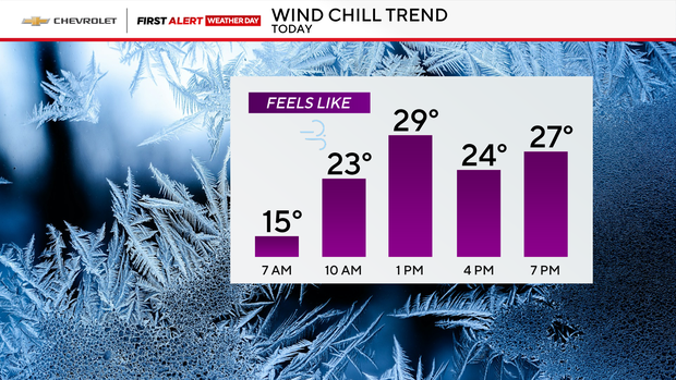
Expect partly sunny skies for the afternoon, but don't let that fool you — it stays cold with highs only in the low 30s. There's also a chance of flurries or snow showers south and east of New York City, so keep an eye out if you're traveling in those areas.
Tonight brings mostly cloudy skies and a mix of snow or rain showers in spots. Temperatures dip to around 30 degrees in the city, with the 20s and even teens possible across the suburbs.
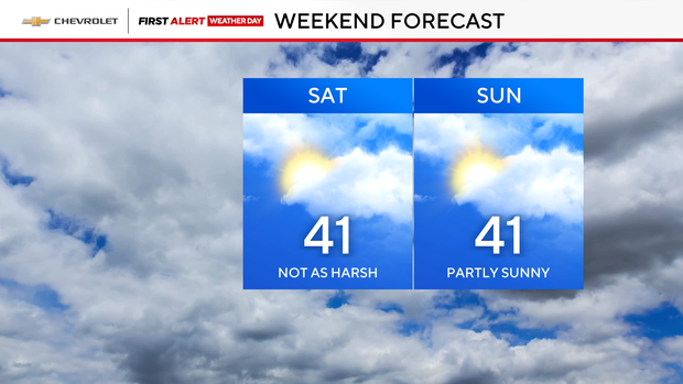
Looking ahead to the weekend: Saturday starts with a leftover shower east of NYC, then turns milder — highs near 40 degrees. Sunday looks partly sunny and seasonable, also around 40 degrees.
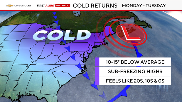
Don't get too comfortable, though. Monday and Tuesday bring the cold back, with highs in the 30s and wind chills in the 20s.
Click here to check the latest weather watches, warnings and alerts.