Southeast Michigan facing another day of potentially severe weather on Wednesday


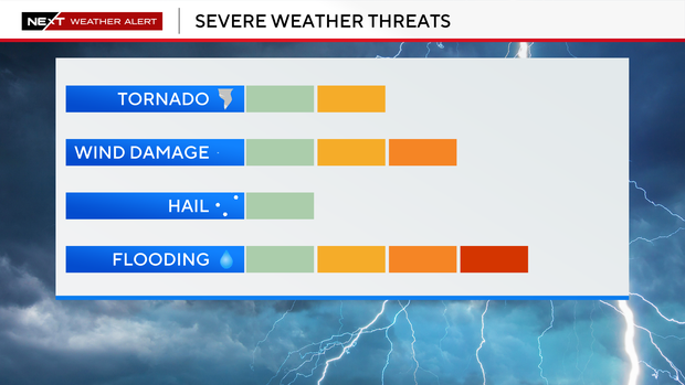
Southeast Michigan is facing another day of potentially severe weather on Wednesday, with damaging wind gusts, large hail, torrential rainfall, and a few isolated tornadoes all possible as a strong storm system moves through the Great Lakes.
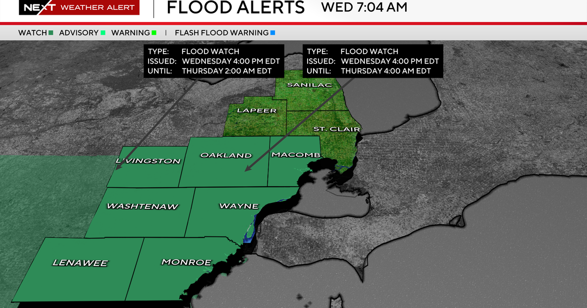
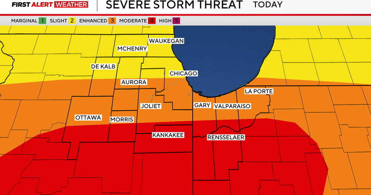
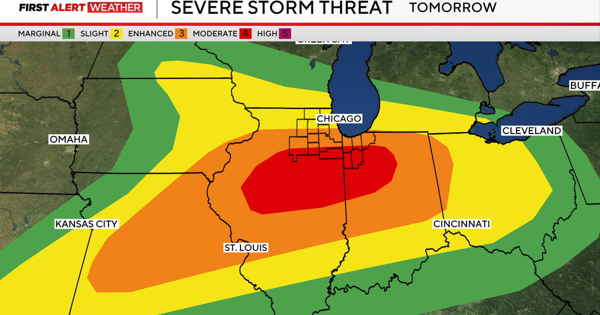
The strongest risk for severe weather today is over Illinois and Indiana, according to the National Weather Service Storm Prediction Center. But Southern Lower Michigan, including the Metro Detroit area, was considered to be at a slight risk (2 out of 5) for severe weather as of the forecasts issued on Wednesday morning. The weather service also has issued a flood watch for much of Southeast Michigan.
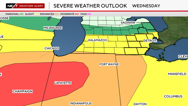
The greatest threat is expected between late afternoon and the overnight hours when the strongest thunderstorms are forecast to track across Metro Detroit and surrounding communities.
The past few weeks have been a busy severe weather time in the Great Lakes region, with storms repeatedly striking in Michigan, Indiana, and Illinois. Michigan has already seen 21 confirmed tornadoes during 2026; the state normally sees 15 to 17 a year.
Stay informed
The CBS News Detroit weather team has declared Wednesday to be a NEXT Weather Alert Day. That means the meteorologists are stepping up forecasts and announcements as needed.
Should circumstances warrant, the CBS News Detroit weather team will livetrack the storm. You can follow the reports on air, online, on our mobile app and on our social media accounts such as YouTube.