Strong storms, heavy rain increase flood threat in North Texas Thursday
Thursday is a First Alert Weather Day due to several rounds of heavy rain and isolated severe storms.
It has been a very active past 24 hours with multiple rounds of rain and storms.
While storms have been strong with very heavy rainfall, they have remained below severe limits.
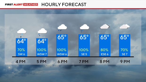
Flooding continues to be the main threat as we head through the evening hours across the metroplex.
An isolated severe storm is possible, mainly south of I-20.
Rain will continue to fill in from the west over the next couple of hours and taper off from west to east around 9 p.m.
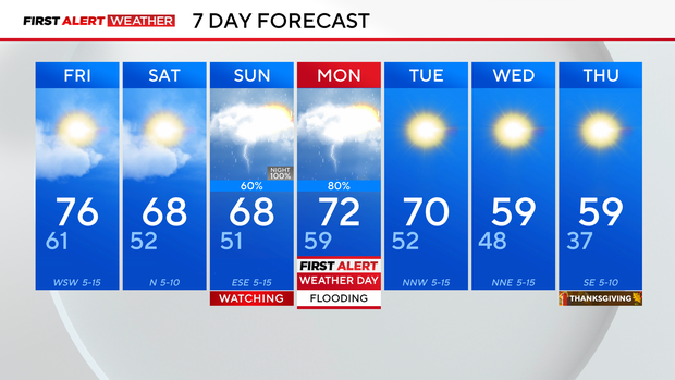
Patchy fog is possible on Friday morning before sunshine returns in the afternoon hours with highs in the mid-70s.
After a brief break in the precipitation on Friday and Saturday, our next system moves in Sunday night into Monday with widespread rain possible.
Heading towards Thanksgiving, temperatures are cooling off and feeling more like the season.
A first Alert Weather Day has been called for Monday.