Warm and breezy week ahead for North Texas with isolated storms and elevated fire danger

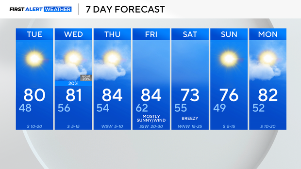
After a cold weekend in North Texas, above-average temperatures are settling in for the workweek.
Temperatures were 5-10 degrees above average on Monday, and the warming trend is expected to continue throughout the week.
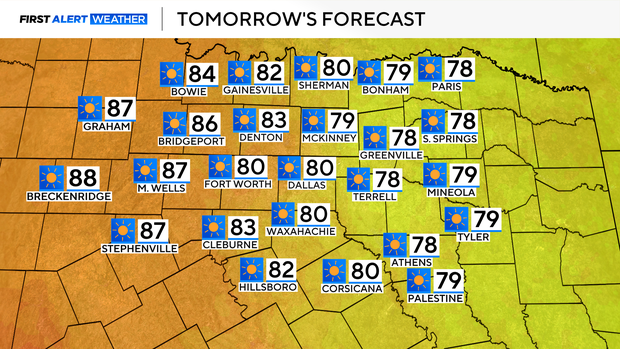
On Tuesday, highs are forecasted to reach the lower 80s, driven by a strong southerly wind.
As we head into Wednesday, a dryline will develop, bringing the threat of isolated storms, mainly east of I-35. The timeframe for this will be primarily in the afternoon and evening.
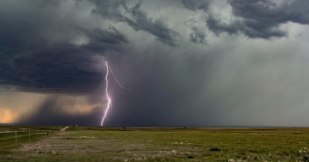
While these storms are expected to be fairly isolated, those that do develop will pack a punch, bringing the threat of damaging winds and large hail.

We will experience breezy conditions from Tuesday through Thursday. Combined with incredibly dry air, this will bring an elevated fire threat, mainly along and west of I-35.

The fire threat will escalate from elevated to critical on Friday as a low-pressure system and cold front move through the Plains, bringing wind gusts of 50-55 mph to North Texas.
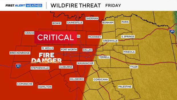
This means any fires that do start will have the potential to spread very rapidly. As a result, it is recommended to avoid activities that may cause a spark and to refrain from outdoor burning.
A cold front will move through from Friday into Saturday, dropping temperatures back into the 70s for the weekend.