North Texas braces for winter weather, arctic air at end of week


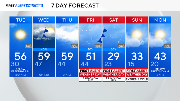
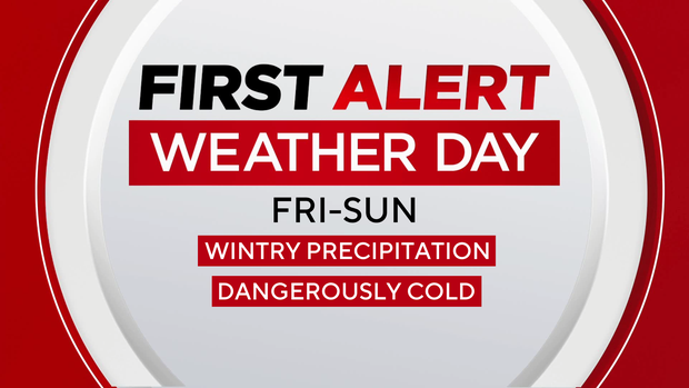
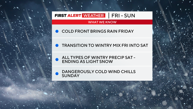
An arctic air mass is set to bring dangerously cold air and wintry precipitation to North Texas this weekend. We have issued First Alert Weather Days for Friday through Sunday for all of this.
Until then, we have fairly seasonable temperatures through the midweek. A few scattered rain showers develop mainly along and east of I-35 late Tuesday into Wednesday morning before clearing up. Thursday is still a mild, just cloudy day. That is all out ahead of an arctic air mass that spills cold air, with an area of low pressure rolling through the region.
Will it snow in North Texas?
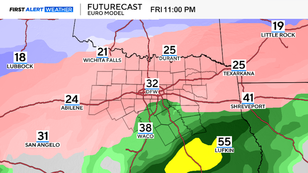
While still 4-5 days out, most of our long-range modeling brings rain at the onset on Friday, with highs still near 50. However, a cold front rolls in sometime Friday afternoon-evening, which leads to a changeover from rain to a wintry mix.
This brings threats of freezing rain and sleet. Eventually, as that air continues to cool, a changeover to snow for parts of North Texas is expected on Saturday.
While the precipitation wraps up late-day Saturday, we are left with the coldest air of the weekend on Sunday morning, with lows dipping into the teens, and wind chills in the single digits for parts of the region. Temperatures stay near to just below freezing until Monday afternoon, which is when the bulk of this would start to melt.
Keep an eye on the forecast as we fine-tune details, and make your cold-weather preparations ahead of time, while the forecast is still mild.