Warm end to the week before cold front brings strong storm threat to North Texas


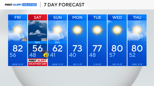
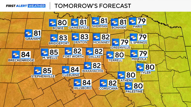
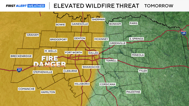
High temperatures settled close to normal for this time of year on this Thursday in North Texas. It is very breezy out, and that breeze will linger through Friday afternoon, with gusts as high as 30-35 mph for the metroplex.
Those winds are out of the south, which will continue to boost temperatures into Friday, with highs in the lower 80s for North Texas.
Breezy conditions and low relative humidity will bring an elevated fire threat once again on Friday.
Clouds build Friday evening, ahead of our next low-pressure system and cold front. That system will increase shower chances overnight and into Saturday.
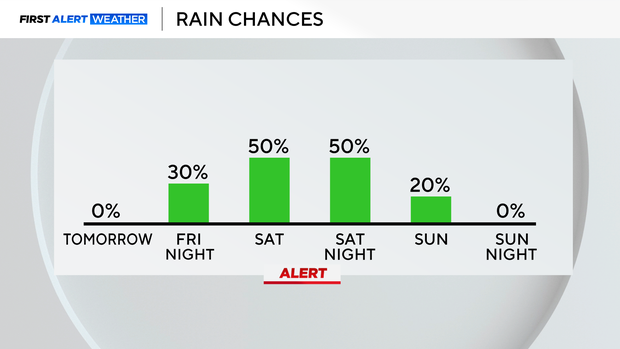
Expect spotty rain showers early Saturday morning. Those showers will turn a bit more widespread and scattered into Saturday afternoon.
We'll also be looking at the threat for a few strong to severe thunderstorms on Saturday, primarily from late morning through early evening. Primary threats for North Texas would be strong, gusty winds and hail. For this reason, we have issued a First Alert Weather Day for Saturday.
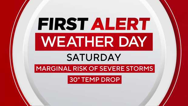
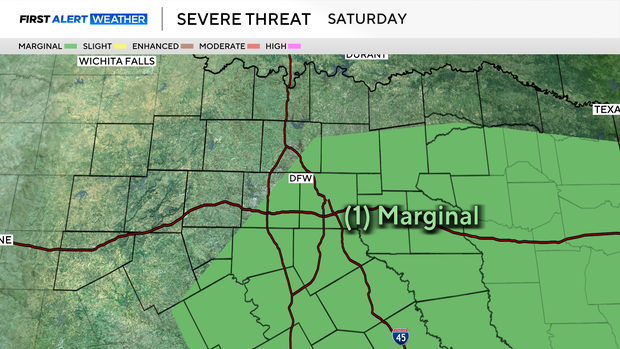
The Storm Prediction Center has parts of our area under a Marginal (level 1-out-of-5) threat for severe storms.
This front also drops temperatures back into the middle 50s for Saturday.
Showers clear up into early Sunday morning, then skies will gradually give way to more sunshine Sunday afternoon. North Texas will be looking at highs in the lower 60s to round out the weekend.
By next week, warmer temperatures and dry weather return, with highs warming through the 70s and eventually into the 80s by midweek.
We will once again be looking at an elevated grass fire threat as a result of low relative humidity and breezy conditions.