Heat advisory continues in North Texas before rain brings cooler temperatures for the weekend
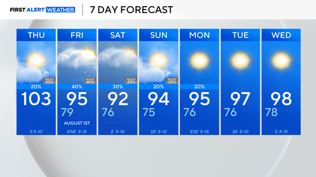
It's almost the weekend and the end of triple-digit temperatures for a while in North Texas.
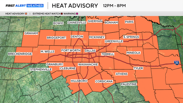
Thursday is another scorcher with highs around 102-103 degrees. The consecutive days of hot temperatures have prompted another heat advisory for the area from noon until 8 p.m.
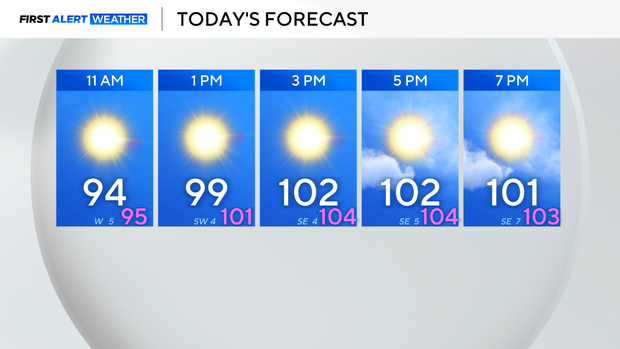
Thursday won't be quite as humid as earlier this week and drier air will mix down to the surface this afternoon dropping dew points into the 50s. While it won't be overly humid, it will still be hot with temperatures soaring into the triple digits for the third day in a row.
The drier air means it will feel close to the actual air temperature.
There is another air quality alert for the metroplex and surrounding counties. Dallas-Fort Worth is in the unhealthy category, so minimize time outdoors if you have respiratory issues.
A weak front will work its way south from Oklahoma today, moving into North Texas this evening. Spotty showers and a few storms are possible this evening due to the front.
The front stalls out in the area for the next couple of days, keeping scattered rain and storm chances in the forecast.
Widespread severe weather is not expected, but an isolated strong to marginally severe storm is possible with downburst winds.
The additional clouds and showers mean temperatures will be cooler, but humidity will be higher, so it will still feel around 100 degrees.
A storm complex could arrive late Sunday night into Monday morning, before high pressure re-establishes itself next week.