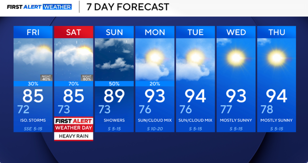
North Texas to stay warm, humid amid chance of isolated storms


A more active weather pattern is setting up as we head into the weekend.
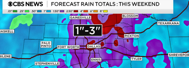
While storm coverage remains scattered Thursday and Friday, the highest chance for widespread showers and thunderstorms will arrive Friday night and continue through Sunday. The severe weather threat remains low, but any stronger storms could produce gusty winds, frequent lightning and locally heavy rainfall. Flooding concerns may increase in locations that receive multiple rounds of rain this weekend.
Friday, a few isolated showers are possible during the morning, but the better chance for scattered storms arrives during the afternoon and evening. Coverage will still be hit-or-miss, and many locations may remain dry. Highs will be in the upper 80s.
Friday night, rain and storm coverage will increase from west to east as an upper-level disturbance approaches Texas. This marks the beginning of our most active period of weather heading into the weekend.
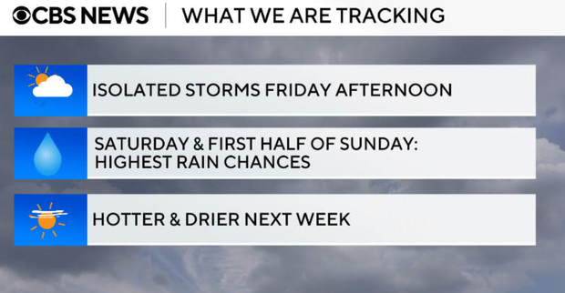
Saturday currently appears to be the wettest day of the forecast period. Expect multiple opportunities for showers and thunderstorms throughout the day. While there will be dry periods, several rounds of rain are possible. Locally heavy rainfall may lead to minor flooding issues in low-lying and poorly drained areas.
Sunday, additional showers and thunderstorms remain likely, especially during the first half of the day. Rain chances should gradually decrease later Sunday as the disturbance begins to move away.
Conditions begin to improve early next week as high pressure builds back into the region. Rain chances will steadily decrease, while temperatures climb back into the 90s.