Isolated, scattered storms possible as North Texas heats back up by the weekend


Scattered showers and thunderstorms are expected Tuesday afternoon and evening. While severe weather is not expected, any storm will be capable of producing heavy rainfall, frequent lightning, and isolated flash flooding.
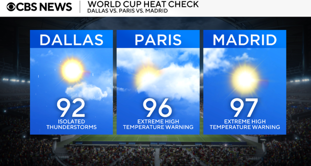
What we're watching Tuesday
- Scattered showers and storms redevelop this afternoon, especially south of I-20.
- Localized flash flooding remains the primary concern where storms repeatedly move over the same locations.
- Temperatures stay below normal with highs mainly in the upper 80s to near 90.
- Rain chances continue Wednesday before gradually decreasing Thursday and Friday.
- Hotter, drier summer weather returns this weekend with highs back in the 90s.
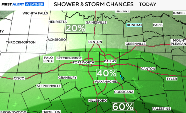
Expect another round of scattered showers and thunderstorms to develop, with the greatest coverage south of I-20. Storms will be slow-moving, producing brief torrential rainfall, lightning and isolated flooding. Most severe weather is not expected, although a few storms may produce gusty winds.
Storms gradually diminish after sunset with partly cloudy skies overnight. Lows fall into the lower 70s.
Another round of storms Wednesday
Another round of scattered afternoon and evening showers and thunderstorms develops. Coverage may actually be a little greater across North Texas than today. Highs remain below normal in the upper 80s to low 90s.
Thursday, rain chances begin decreasing as the upper-level disturbance shifts west. A few isolated afternoon storms remain possible, mainly west of I-35 and Highway 281. Highs stay in the upper 80s to lower 90s.
Only isolated afternoon storms remain possible on Friday. More sunshine returns with temperatures slowly warming.
Typical July weather returns this weekend with mostly sunny skies, much lower rain chances and afternoon highs climbing well into the 90s.


