Scattered storms build up across North Texas for Sunday

For North Texas Sunday, scattered storms are likely in the afternoon, with coverage increasing by evening due to a frontal boundary. As of now, the Storm Prediction Center has issued a Marginal Risk (level 1 out of 5) for severe storms across North Texas. These storms may contain gusty winds, hail, and heavy downpours. Flooding will also be a primary concern.
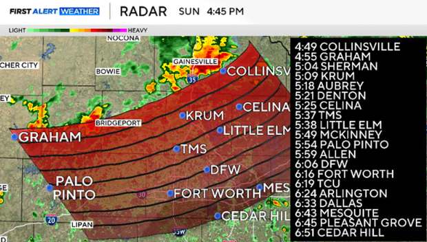
A line of storms is moving across North Texas, southeast at 30 mph. The severe threat is low, but heavy rain and lightning are possible. The storm is estimated to move through the metroplex between 6 p.m. and 7 p.m.
Sunday will be cloudy, with the high depending on whether a shower or storm occurs over the area. Highs should reach the low to mid-90s today, with a southeasterly wind around 5 mph. Sunday night, showers and storms continue. The heaviest rain is expected east of I-35.
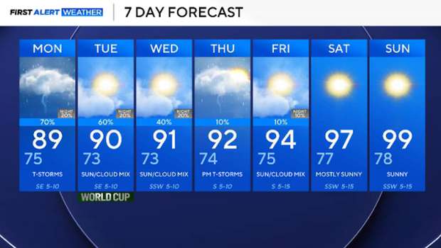
Monday afternoon will be cloudy, rainy and warm. Due to the rain, highs will dip into the 80s.
On Tuesday, North Texas will see showers and chances of storms from noon to 6 p.m., with high temperatures in the 90s.
Rain chances will continue next week, slowly dwindling by Friday.
Temperatures dip below average in the lower 90s for the first half but quickly rebound by the second half of the week. Expect sunshine and temperatures flirting with the triple digits by next weekend.