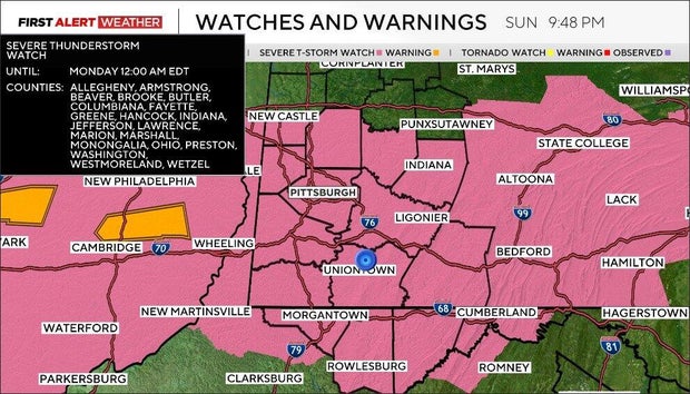
Severe thunderstorm watch issued for Pittsburgh area; storms end overnight with cooler conditions Monday

A severe thunderstorm watch has been issued for parts of Ohio, Maryland, West Virginia, and most of the Pittsburgh area until 12 a.m. Monday, the National Weather Service has announced.
First Alert: Through Sunday evening due to severe storm threat
We've seen scattered to numerous thunderstorms develop since 3 p.m. These cells are generally moving from west to east/southeast at around 50 mph. The greatest threat with any storms continues to be large hail accompanied by strong downburst winds.
Temperatures have warmed well into the upper 70s to mid 80s across our region, but dew points are in the upper 40s to low 50s, yielding high cloud bases. This keeps tornado potential minimal, and we are not anticipating tornadoes, but the strong winds aloft in the atmosphere, plus available storm fuel, will favor large hail in some storms.
As the cells weaken, they will produce downburst winds.
The storms that are ongoing on radar right now will continue to move to the east through around 8-9 p.m. and impact areas between the I-70 and Route 422 corridors.
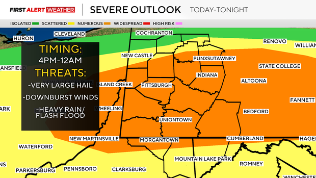
The more severe potential will occur from now through around 10 p.m., with the storms currently ongoing on radar.
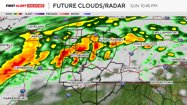
A final larger line of storms will take shape in central Ohio and move across our area between 9 p.m. and 2 a.m.
This late evening wave of storms will have the potential to be strong to severe, but overall trends should favor weakening as the cold front outpaces it.
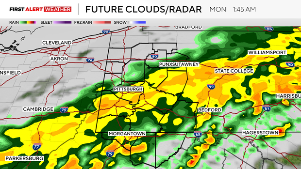
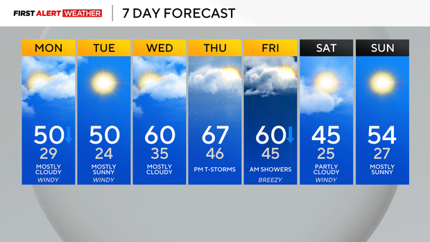
Monday will feature falling temperatures with most of the day in the 40s and mostly cloudy skies. Tuesday will be the coldest morning of the week with light winds, clear skies, and temperatures dropping into the low to mid-20s.
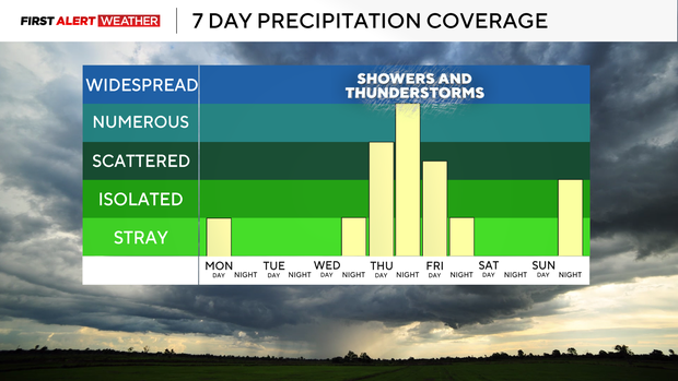
A warming trend will prevail from Tuesday afternoon through Thursday ahead of another strong wave of low pressure and a cold front.
The greatest amount of energy for storms looks to line up to our west at the moment, but we should still have at least some fuel to support storms late Thursday into Friday. More cold air will move in on the backside of this front going into next weekend.