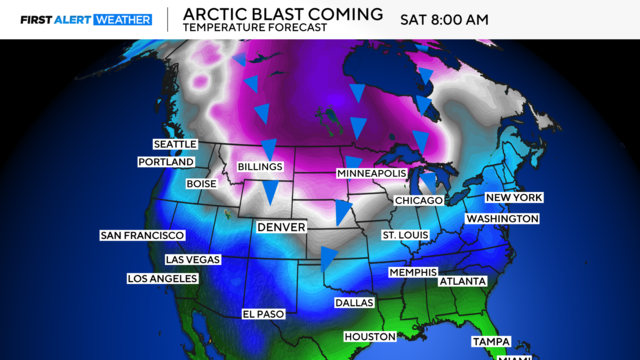
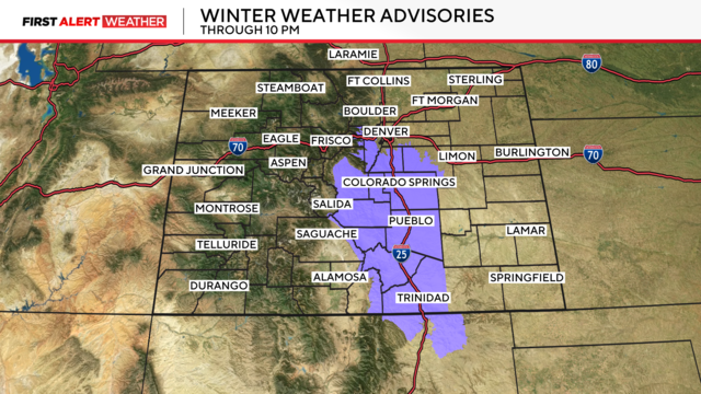
Snow and windchills as low as -30F are on the way
A dangerously cold Colorado weekend is approaching.
Watch CBS News

A dangerously cold Colorado weekend is approaching.
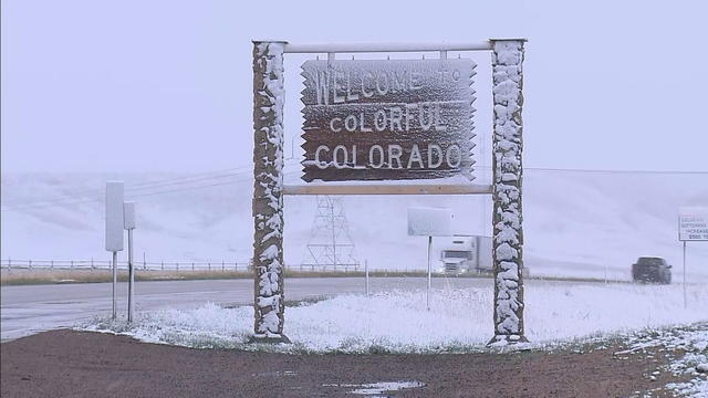
Cold and snowy weather is around the corner in the Denver metro area and Colorado's Front Range.
Another storm will bring the chance for accumulating snow during the Thursday morning commute.

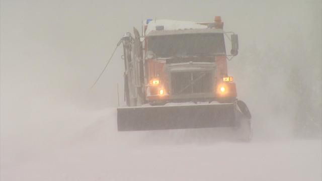
High winds across the Front Range will lead to near-critical fire weather along all of I-25. While this is going on, snow will be dumping across I-70 with winds to 50MPH creating treacherous travel.
Travel will be near-treacherous at times across I-70. Travel will deteriorate west of Georgetown to Glenwood Springs, a 113-mile stretch of the major interstate.
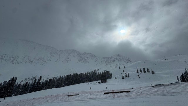
Near-treacherous travel conditions are expected at times across Interstate 70 in the Colorado high country over the next few days.

The official definition of a White Christmas is at least 1 inch of snow on the ground.
Light snow is expected to continue over the mountains and portions of the Front Range through the evening hours.
The record snowiest November occurred in 1946 when 42.6" fell.
Travel should be avoided in the Colorado high country for a roughly 36-hour window beginning Tuesday morning and lasting until Wednesday afternoon.
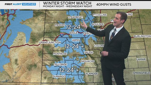
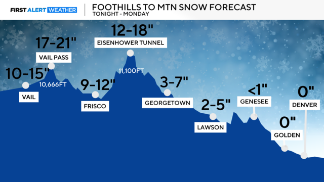
Widespread 1-2 feet of snow is expected across Colorado's high country, Denver will see accumulations Wednesday.
One of the big things we look at is what El Nino and La Nino are doing. It all has to do with the water temperatures off the coast of South America.
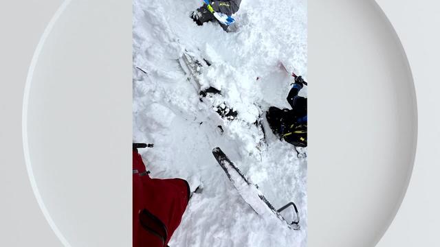
Last February after a big snowstorm in Grand Mesa one group of snowmobilers hit the slopes for what they thought would be a fun afternoon. The fun came to a screeching halt when one of those snowmobilers triggered a small avalanche.
Colorado is home to some of the wildest weather across the United States. After all, the old saying goes "The weather starts east of the Rockies."
This significant difference in elevation can help play a pivotal role in deciding which place will be the big winner during a snowstorm. Three major features that drive northern Colorado's weather include the Front Range Mountains, Palmer Divide, and the Cheyenne Ridge.