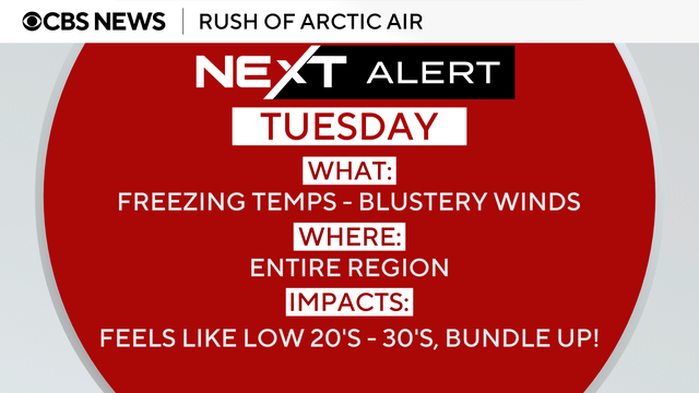
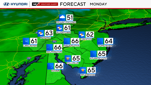
Monday turns colder before a taste of winter Tuesday in Philly area
The Philadelphia area can expect cooler temperatures Monday before even colder conditions Tuesday.
Watch CBS News

The Philadelphia area can expect cooler temperatures Monday before even colder conditions Tuesday.
Weather conditions are changing Sunday before cold temperatures arrive next week.
Freezing temperatures creep into the Philadelphia area in the coming days.
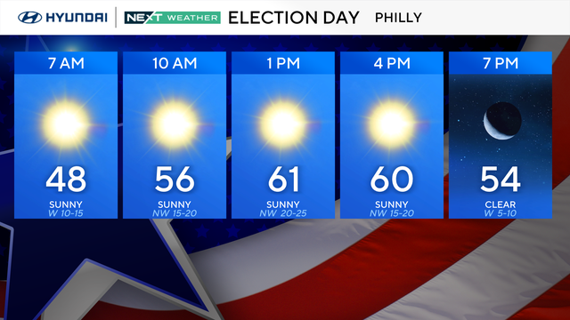
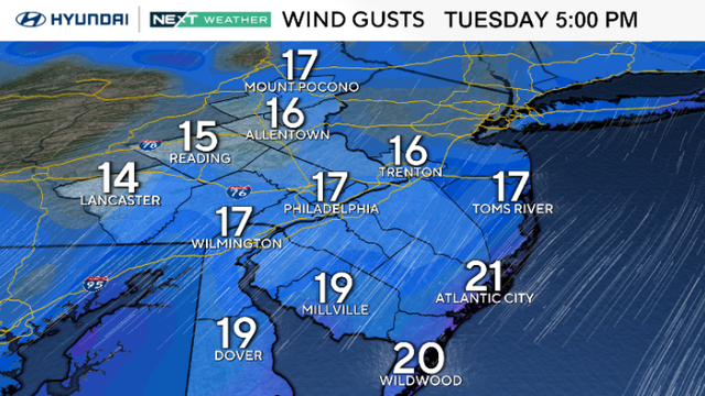
Election Day Tuesday will bring a return to sunshine, but the wind gusts will pick up as a warm front approaches the Philadelphia area.

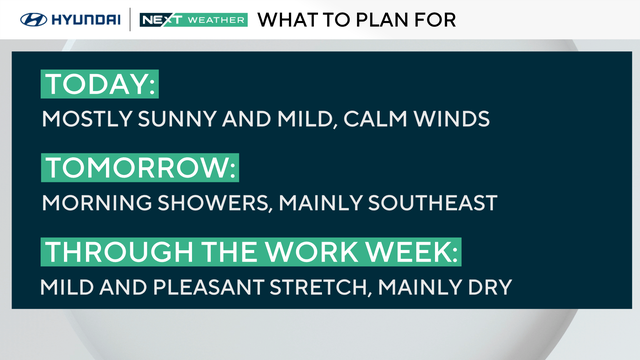
It's been a dreary start to the week with clouds and a few light showers, but clouds will break for sunshine in the afternoon.
Milder, pleasant weather returns Sunday before a few showers early next week.
Skies will be mostly clear across the Philadelphia region, with more clouds lingering farther south.
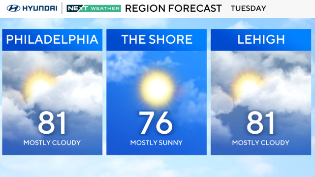
The Philadelphia area can expect a sunny Tuesday with temperatures near 70 degrees.
Overnight storms have moved out, making way for cooler air across the Philadelphia area this week.
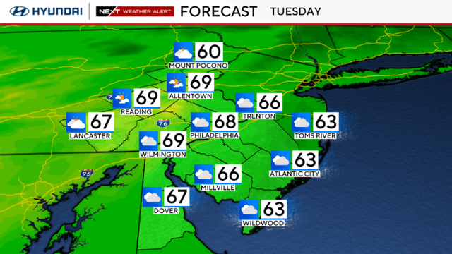
Tuesday will be cloudy and breezy in the Philadelphia area with highs in the 60s.
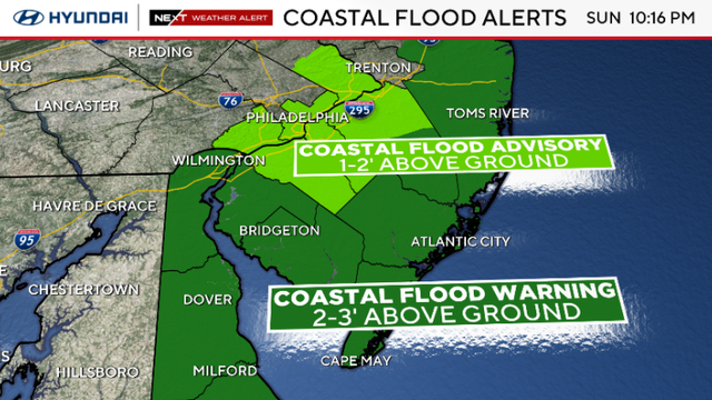
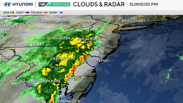
The significant coastal storm continues to impact the Philadelphia region and Jersey Shore on Monday.

Rainy and windy Sunday, especially closer to the coast. Coastal flooding is expected at high tides.
Tuesday should be mostly dry and comfortable in the Philadelphia region, but rain is on the way.
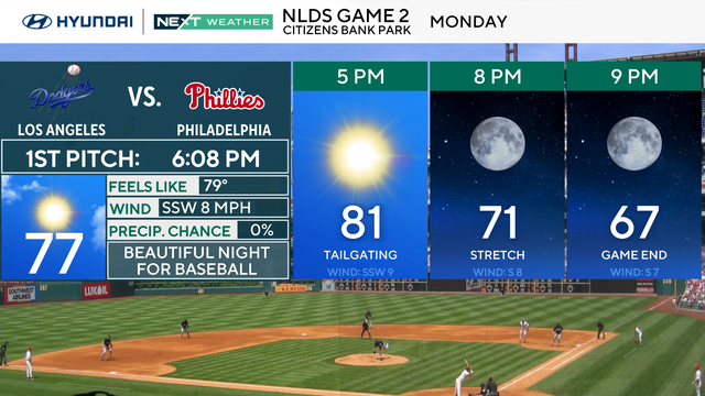
The warmer trend sticks around through Monday and Tuesday, with highs again in the low 80s in the Philadelphia region.
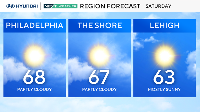
It's a sunny and unseasonably warm Sunday in the Philadelphia area. Skies will be mostly clear with patches of fog later in the night.