Western Pennsylvania is expected to warm up this week ahead of a stormy pattern
After beautiful sunshine and seasonable highs in the 60s on Sunday, we dip into the upper 30s to lower 40s by Monday morning, which will be seasonably chilly again. Some patchy frost is possible, especially outside of Pittsburgh.
First Alert: Tuesday PM (Severe potential late afternoon/evening)
Climate: Average High: 67 | Average Low: 45
April Precipitation: 4.27" (+1.40")
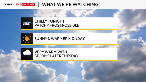
Monday will warm even further as high pressure moves east, and winds shift to the southwest, pushing in a warmer air mass. Afternoon temperatures should reach the low to mid-70s, with some of our southern zones getting closer to 80 degrees.
Tuesday is now a First Alert Weather Day for the possibility of severe storms in the afternoon and evening. A strong cold front will pass through our region, plowing into the moist, humid air in place.
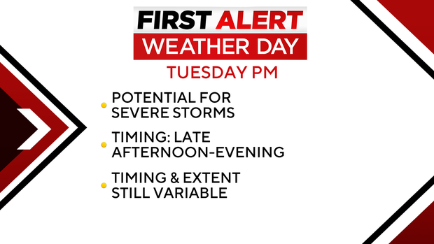
The time to watch will be after 3-4 p.m. Tuesday through midnight, with damaging wind and hail the main threats. If storms don't hold together as they head east through Ohio, and if we remain cloudy, that could limit the extent of the severe risk.
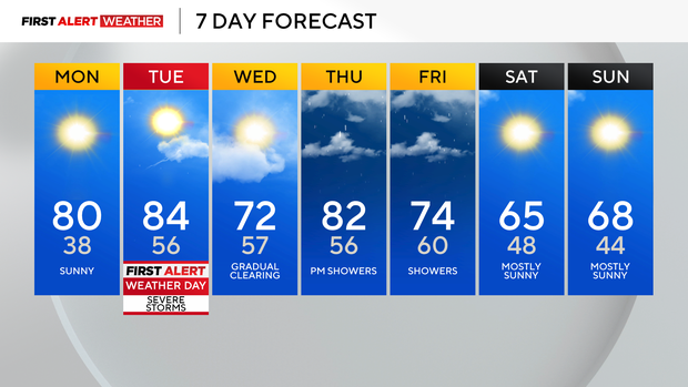
The Storm Prediction Center has a level 3 out of 5 risk in place for Allegheny and Northern Washington County north, with a somewhat lesser risk in areas to the south. This cold front will stall out to the south on Wednesday but lift back north on Thursday, bringing another round of rain into Friday.


