Unseasonably hot temperatures coming to Pittsburgh this week

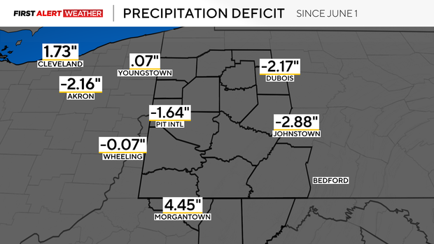
Today will be the 13th consecutive day without precipitation at Pittsburgh Airport, which will continue to add to our slight seasonal deficit in rainfall.
WEATHER LINKS:
Current Conditions | School Closings & Delays | Submit Your Weather Photos
In general, the northern half of our viewing area has been running a bit drier than the southern half, but this is very location-dependent.
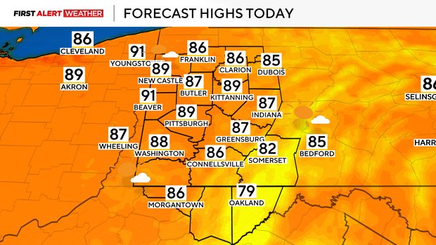
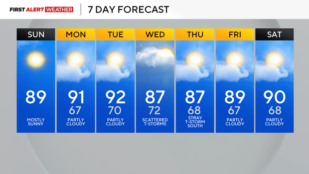
Not only will today be dry, but temperatures will likely be a couple of degrees higher than the previous day. Yesterday, we hit 87, and today it is likely we will reach 89°F with heat indices in the low to mid-90s. Monday and Tuesday are also likely to reach 90 degrees, with heat indices in the low to mid-90s.
Models are showing a very weak disturbance in the mid-levels of the atmosphere that may lead to a few more cumulus clouds during the day on Monday. There is a very low chance of a couple of these "attempting" at towering up enough to produce a stray shower during the early-mid afternoon hours, but dry mid-level air will hinder higher precipitation chances.
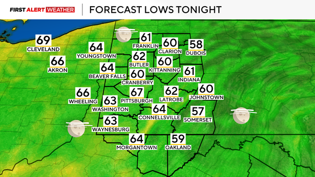
Thankfully, dew points will only max out in the low to mid-60s, which should help keep heat indices from getting to hazardous levels, but it will still be very uncomfortable and unusually hot for this time of year.
The next front to keep an eye on still has its eyes set on us by Wednesday. Some isolated storms may occur as early as Tuesday evening and night as low-level moisture and the outer fringes of this system reach us.
Better chances of precipitation appear likely during the morning to midday hours of Wednesday. Given the time of day this disturbance will pass through--when the atmosphere is least unstable, this should keep the severe weather threat very low, but also not maximize rainfall intensity or coverage.
Hopefully, we will end the dry streak that has been growing in our area, but even if we do, total precipitation amounts will likely not be much. A few lingering storms are possible Wednesday night into Thursday, mainly over the southern half of our area as the front gradually weakens and falls apart. Do not expect a strong surge of cooler air following this frontal passage, as temperatures will remain above normal for the entire forecast period over the next week.
Stay up to date with the KDKA Mobile App – which you can download here!