Warmer air will be moving into the Pittsburgh area this afternoon
Warmer air will be moving into the Pittsburgh area this afternoon.
Any Alert Days Ahead? Thursday may end up being one.
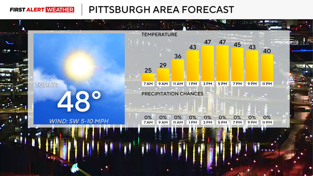
Aware: Winds will start the day out of the north, then will change to the southwest this afternoon.
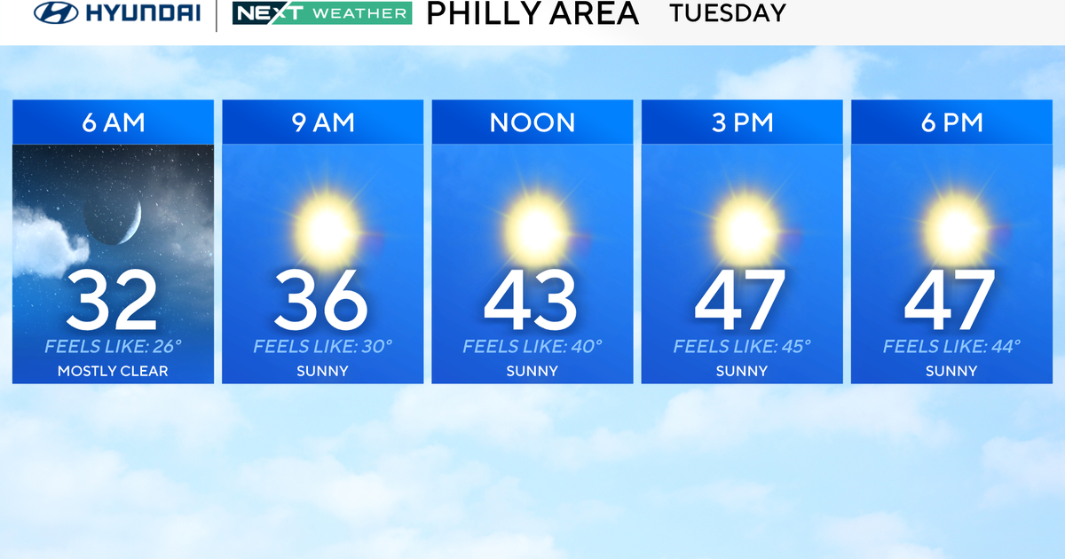
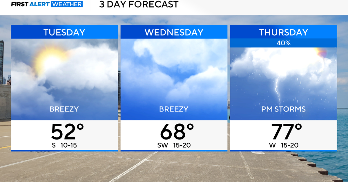
While we won't see the wild temperature swing from Sunday to Monday anytime soon (where we saw temperatures nearly 50 degrees colder than the previous day), the ups and downs of spring temperatures will continue through the week. Today, we start to warm back up with morning temperatures in the mid to upper 20s, and highs today hitting the mid-40s. We should see bountiful sunshine in the morning with partly cloudy afternoon skies. Winds will shift from the north this morning to the southwest this afternoon. I have noon temperatures in the upper 30s.
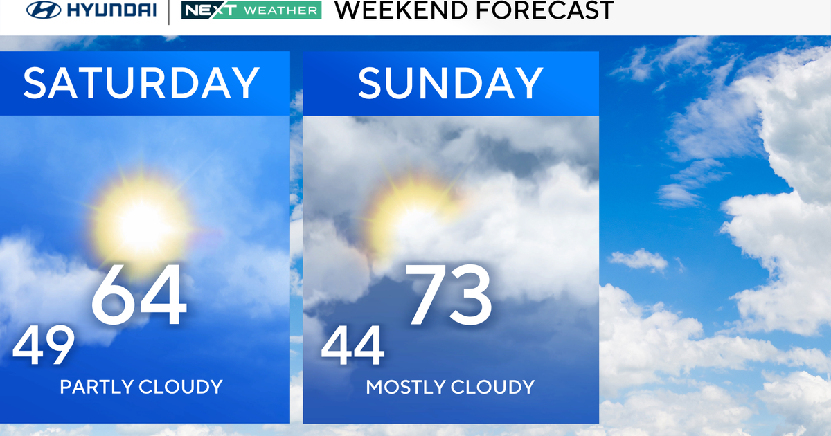
Looking ahead, temperatures on Wednesday will be a good ten to fifteen degrees warmer than they are today. I have highs hitting the low 60s with morning temperatures in the mid-30s. Highs on Thursday will be close to 70 degrees, but there will also be a storm chance late on Thursday. Thursday is a potential First Alert Weather Day due to the storm chance, with large hail being the biggest concern.
Thursday storms right now appear to arrive after sunset. Downpours and frequent lightning should be expected. At this point, the Storm Prediction Center has us in a level 1 out of 5 storm level. If all things stay the same, this will go up.
Behind Thursday's storm chance will come cooler weather as we head into the weekend.
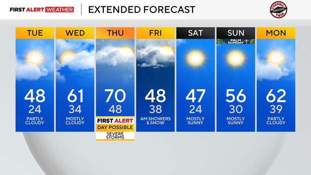
Highs on both Friday and Saturday will only be in the 40s.
I have highs in the 50s on Sunday.