NEXT Weather: Clouds rolling in before scattered showers; steadier rain on Friday
Meteorologist Grant Gilmore says the bulk of this first round of rain will track to our north, and then more steady rain will be over the region on Friday.
Watch CBS News
Meteorologist Grant Gilmore says the bulk of this first round of rain will track to our north, and then more steady rain will be over the region on Friday.

After a sunny and quiet week, rain showers move in Thursday into Friday. Expect a cool down with high temps only reach the 30s Saturday, but Tammie Souza is keeping an eye on our first chance for 60 degrees this year next week.

The Philadelphia region can expect light showers Thursday afternoon, and there's a chance of snow turning to rain in the Poconos. Rain will fall Friday morning as well.

Bill Kelly has the latest weather forecast for the Philadelphia region.

It's more quiet weather on Wednesday before clouds and PM rain roll in on Thursday, Grant Gilmore reports.
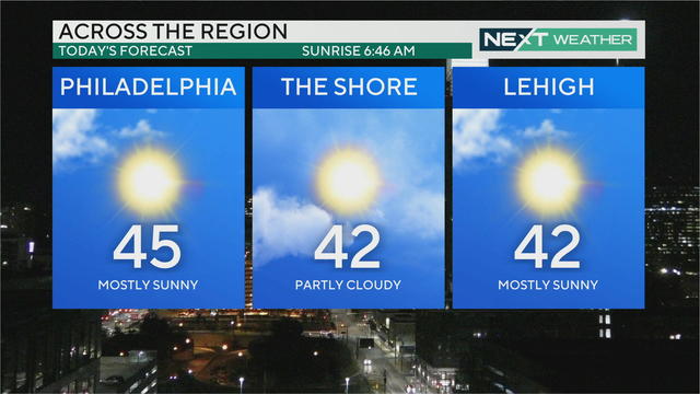
Temps will warm to the mid-40s by Wednesday afternoon. Thursday starts sunny but turns cloudy later in the day as the region's next chance for rain moves in from the west.

Wednesday is a sunny winter day but warmer weather and rain are on the way, Kate Bilo reports.

The Philadelphia region can expect clear and cold conditions overnight and sun and seasonable temperatures Wednesday with a high of 46 degrees.

Bill Kelly has the latest weather forecast for the Philadelphia region.
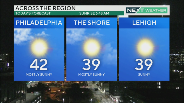
High temperatures will top out in the low-to-mid-40s Tuesday and the weather will remain relatively calm before the next chance for rain at the end of the week.

High temperatures will top out in the low-to-mid-40s Tuesday and the weather will remain relatively calm before the next chance for rain at the end of the week.

Bill Kelly says Philadelphia will be sunny and cool on Tuesday with a high of 41 degrees.

Bill Kelly has the latest weather forecast for the Philadelphia region.
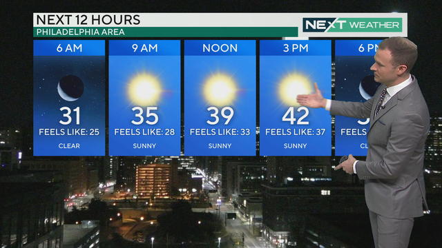
While actual high temperatures will warm into the low 40s Monday, wind chills will keep the feels-like temps in the 30s for a sunny and seasonable Presidents Day.

Temps will warm into the low 40s today, but wind chills will keep the feels-like temps in the 30s. Lots of sunshine Monday through Wednesday before clouds move Thursday ahead of our next chance for rain. Meteorologist Grant Gilmore has your forecast.

The Philadelphia region can expect a sunny and seasonable Presidents Day Monday and a sunny stretch of days to follow.

Andrew Kozak has the latest weather forecast for the Philadelphia region.
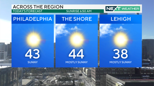
The first half of the week will be sunny and seasonable with high temperatures hovering in the low-to-mid-40s. Warmer temps in the 50s arrive Wednesday ahead of our next chance for rain.

Expect plenty of sunshine to start this week, and even some warmer temps in the 50s by Wednesday. Tammie Souza has your forecast and is tracking our next chance for rain in the Delaware Valley.

Here's how much snow fell across Pennsylvania and New Jersey - Tammie Souza has the latest.

Storm tracks just south of the area. This is faster and weaker than the Tuesday storm. Cold air is in place so this is a snow event. Snow spreads across the area from midnight to 2 a.m. Grant Gilmore reports.
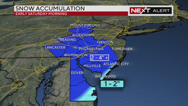
A quick-moving system will bring most of the Philadelphia area between 2-4 inches of snow by Saturday morning.

Wind gusts are making temperatures feel eight to 10 degrees colder - before snow arrives overnight into Saturday morning, Tammie Souza reports.

Grant Gilmore has the latest on a winter storm that will hit the Philadelphia region on Saturday.

Meteorologist Tammie Souza is tracking another storm that could bring another chance for winter weather. Tammie has more on how much snow our region can expect this weekend.