Isolated Saturday afternoon showers, possible storms in the Philadelphia area. Here's the forecast.


The drenching rain pattern from last week has loosened its grip on the Philadelphia area for the weekend. There is still a chance of isolated afternoon showers and storms, but most of the area will remain dry under a combination of sun and clouds.
A flash flood warning was in effect for Delaware County Saturday evening but has been canceled.
Temperatures will hover on either side of 90 both days with a heat index (feels-like) in the mid and upper 90s.
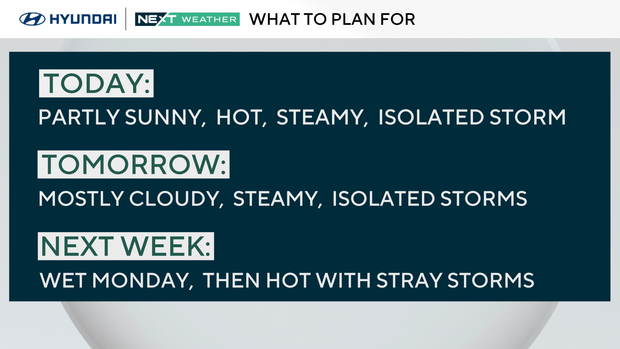
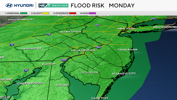
Our focus then turns to Monday as a cold front sweeps past the area, triggering scattered showers and storms. Some storms may be on the gusty side with heavy downpours and localized flooding possible under any storm.
There is a marginal risk of flooding across the area on Monday.
Tuesday through Friday, high pressure returns with mostly sunny skies and a summer-like pattern of isolated storms each afternoon. Highs will be in the low 90s with a heat index near 100.
Here's your 7-day forecast:
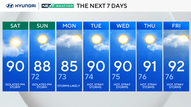
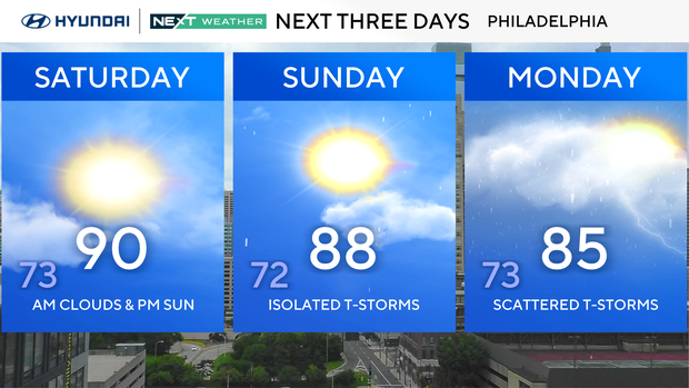
Saturday: Isolated p.m. storm. High 90, Low 72
Sunday: Isolated PM storm. High 88, Low 72
Monday: Storms likely. High 85, Low 73
Tuesday: Hot, stray storms. High 90, Low 74
Wednesday: Hot, stray storms. High 90, Low 75
Thursday: Hot, stray storms. High 91, Low 76.
Friday: Hot, stray storms. High 92, Low 76.


