Snow expected Sunday amid freezing Tri-State Area temperatures. Here's the First Alert Forecast.
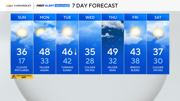
After starting out in the teens Sunday morning, temperatures will only climb into the mid 30s this afternoon
Clouds will continue to thicken through the day ahead of a weak weather system tonight.
Light snow after sunset
The weather stays dry through sunset, but then some light snow moves in from the west, starting in the northwest suburbs. The system will work its way east through the evening, eventually mixing with some rain as it nears the coast.
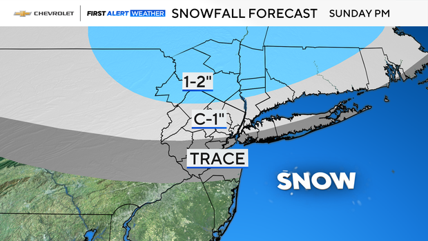
A coating to an inch is possible in and around New York City. The highest accumulations will be farther north, where 1-2" is possible.
Any light snow quickly exits shortly after midnight and any accumulation won't stick around. So by no means will this be anything major, but it's something to keep in mind if you'll be heading out tonight.
Looking ahead
On Monday, temperatures will be back in the 40s to near 50 under mostly cloudy skies. Then, the roller coaster temperature swings continue with another chance of a wintry mix late Wednesday.