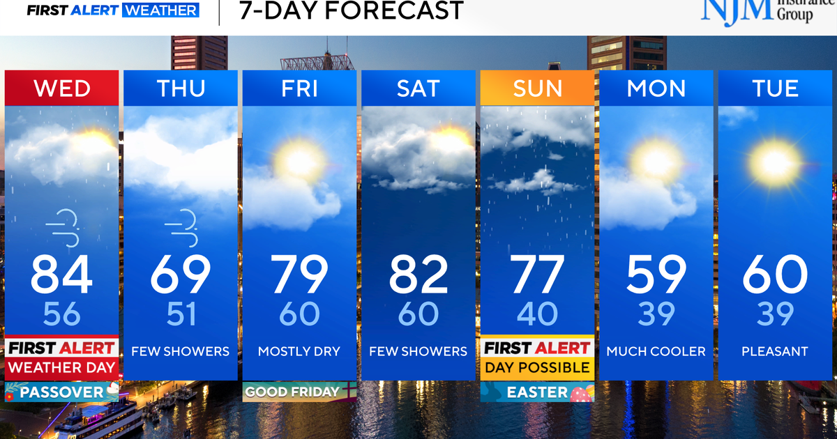
Rainy weather before changing to snow for the New York area
Rainy weather will continue Thursday, and New York will see some snow as temperatures drop in the afternoon.
We started the day in the low 60s and 50s and are slipping into the 40s during the afternoon, with wind chills in the 30s. By the evening, it will be back to cold with wind chills in the 20s.
A First Alert Weather Day has been issued for snowy and cold weather.
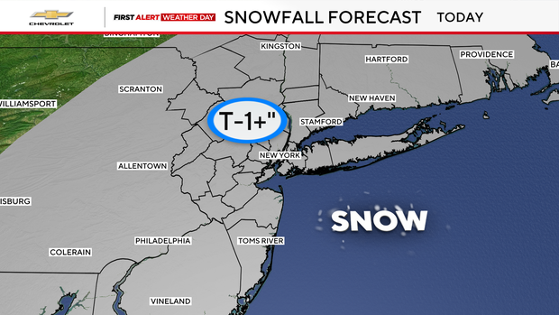
We will start off the day with showers before transitioning to snow as colder air pushes in. Accumulation looks light, generally a trace to an inch, but the bigger story will be falling temperatures.