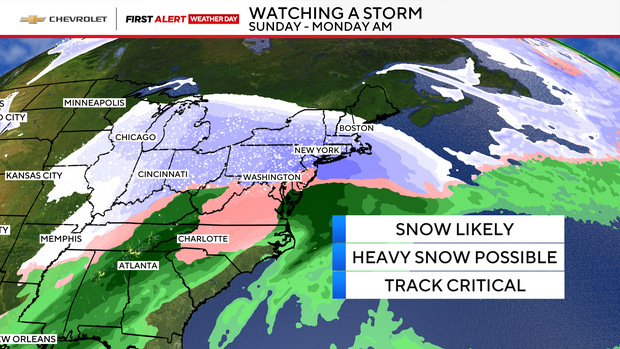
Significant snowfall is possible this weekend for NYC and Tri-State Area. See the forecast.

All eyes are on the weekend as a winter storm threatens the New York and New Jersey region.
Residents in the Tri-State Area felt dangerously cold temperatures Wednesday morning, but there will be a slight break on Thursday.
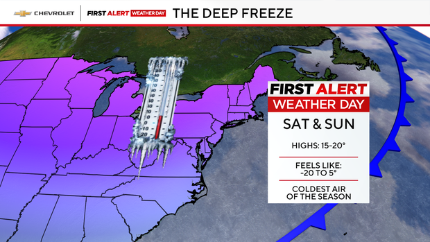
Don't get too comfortable, however, because they will plunge again heading into the weekend. Both Saturday and Sunday will be First Alert Weather Days.
New Yorkers should expect the possibility of more than 6 inches of snow. With a potential winter storm developing late in the weekend, it's shaping up to be an eventful stretch of January weather.
How much snow is NYC getting?
The two main forecast prediction models, European and the American, or GFS, were in agreement earlier Wednesday, but by the evening were less so, with the former predicting 13.9 inches and the latter calling for 9.4 inches through Monday morning. The European has snow beginning late Saturday night and the GFS is saying it will start falling in the early morning hours on Sunday.
The last time Central Park had more than 6 inches of snow on the ground was in January of 2022, where there were 8.3 inches. The last time there was more than a foot happened from Jan. 31-Feb. 3, 2021, when 17.4 inches fell.
There is some uncertainty, however, if (and how much) mixing will occur this time around. If that happens, it would limit our snow totals south of New York City.
The forecast will be fine-tuned in the coming days.
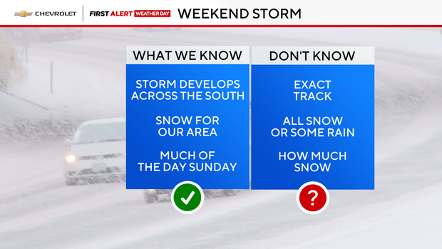
Snow forecast for this weekend
The First Alert Weather Team is very confident an arctic airmass will entrench the Northeast on Saturday and Sunday. Temperatures are expected to be in the teens.
The weekend brings the real punch. Saturday starts with frigid morning wind chills between –20 and 0°, and the afternoon only improves slightly, staying in the –5 to 10° range. As for Sunday, it will also be very cold with wind chills in the single digits.
As far as when this all wraps up, the best estimate is sometime between Sunday night and Monday morning. But by that point, the damage is done, so a messy Monday morning commute is expected.
Wednesday is still frigid, but some relief Thursday
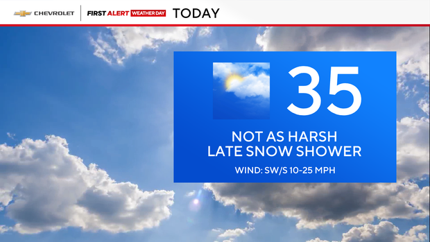
We start today on a bitterly cold note. Morning wind chills range from –10 to 15°, making for a harsh start.
This afternoon brings partly sunny skies and a chance for a late‑day passing snow shower. Highs reach the mid‑30s, though it will still feel like the 20s.
Tonight, a quick snow or rain shower may slide through. It won't be as brutally cold, with wind chills holding in the 20s.
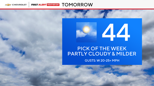
Thursday is no doubt the best weather day of the week, with highs in the 40s and partly cloudy.
Enjoy it while it lasts, because colder air returns on Friday. Expect highs in the 30s, with wind chills stuck in the 20s and teens..