Extremely hot weather returns to New York City area with heat advisory
More extreme weather is on deck for New Yorkers as a heat advisory will be in place this week for parts of the Tri-State Area.
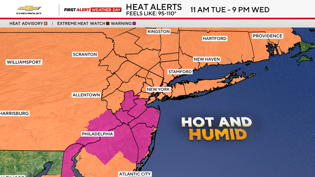
A heat advisory is in place from 11 a.m.Tuesday to 9 p.m. Wednesday for the entire Tri-State area. The feels-like temperatures will range from 95 to over 100 degrees.
There will be an extreme heat warning Wednesday from 10 a.m. to 8 p.m. for central and coastal New Jersey with feels like temperatures over 100 degrees.
Tuesday and Wednesday will be First Alert Weather Days due to extreme heat and humidity.
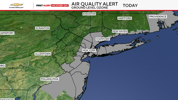
There is also an air quality alert Tuesday for parts of the area including the city, the Lower Hudson Valley, Long Island and parts of New Jersey.
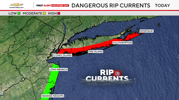
Those who are trying to seek relief from the heat in the ocean also need to be aware of the dangerous rip currents on Tuesday south of the city and along Long Island.
Heat advisory for NYC
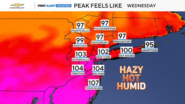
Although the upcoming hot stretch is not expected to be as intense or lengthy as the one at the beginning of July, highs in the mid to upper 90s will be widespread.
Some locations may reach the 100-degree mark once again.
High heat indices will make it feel very oppressive and could lead to heat-related illnesses.
Peak heat is expected Wednesday, but it will still be hot to end the week.
Even without another official heat wave, the city will still add a few more days that are 90 degrees or hotter.
The current count is at nine so far this summer. An average summer in the city has 15 days above 90 degrees. The record in Central Park is 39 days.
Rain possible for the weekend
Precipitation-wise, not much is expected through the upcoming week.
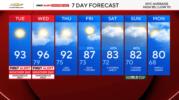
The chance of rain comes back by Friday and Saturday. The weather could bring thunderstorms that may be strong to severe.


