Storm expected to soak Tri-State Area tomorrow. Here's the latest timing.
New York City is seeing sunny start to the week, but a storm is brewing as we head into Halloween.
The system is expected to arrive sometime between Wednesday night and Thursday morning, with the potential for heavy rain, strong winds and coastal flooding.
Our First Alert Weather team is monitoring the latest models to see how the storm might impact trick-or-treating or Halloween plans coming up this weekend.
Tracking rain this week
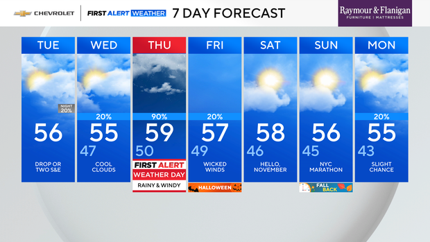
Tuesday was a cool, breezy day with more clouds than we saw Monday.
Wednesday is a little tricky with regards to the cloud cover, but it looks like we'll at least start the day with some clouds. And once again, it looks like the thermometer will get stuck in the mid 50s.
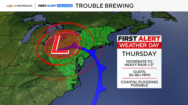
By late tonight, a storm will begin to affect the region.
Right now, all of our forecast models are in agreement that we'll see downpours, strong winds and some coastal flooding on Thursday.
Here are some of the finer details:
- Worst: Midday Thursday into the afternoon
- Moderate to heavy rain: 1-2"
- Wind gusts: 30-40 mph
- Minor coastal flooding expected, locally moderate coastal flooding possible
Halloween weather forecast
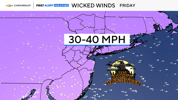
Although Thursday is looking quite ghastly, the Halloween forecast is mostly dry. A few leftover showers are possible early in the day, but they should be long gone once the trick or treaters hit the pavement. A gusty breeze will linger through the day, as well.
It also looks to be much cooler than last year, when the high was 81 degrees, which tied the daily record for warmest Halloween ever. Highs this Halloween will struggle get higher than the mid 50s, making it the coolest Halloween in recent years.


