Weather brings severe thunderstorm risk and wind advisory to NYC. Here's the latest forecast
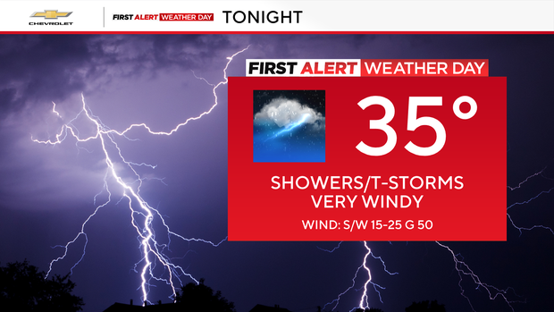
The New York City area will be under a wind advisory Monday with periods of heavy rain and severe thunderstorms expected across the region.
The CBS News New York First Alert Weather Team issued a First Alert Weather Day due to the potential for flash flooding and a tornado risk later this evening.
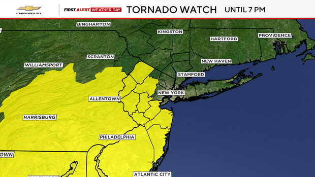
A Tornado Watch was issued for Hunterdon, Mercer, Middlesex, Monmouth, Morris, Ocean, Somerset, Sussex and Warren Counties, but has since been canceled.
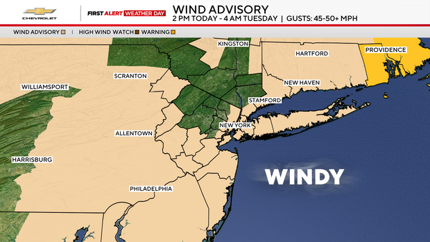
Wind advisory for NYC, Long Island, Connecticut, parts of N.J.
The Wind Advisory covers all of New York City, Long Island, Connecticut and eastern New Jersey, as well as Ulster, Dutchess and Westchester counties, from 2 p.m. Monday through 4 a.m. Tuesday, with peak gusts of 45-50 mph at times.
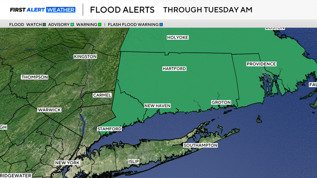
A Flood Watch has been issued for Fairfield County from tonight through Tuesday morning.
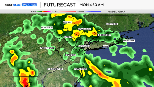
Monday AM commute conditions
As a potent cold front and its attendant low-pressure system approach the Tri-State Area, conditions will rapidly go downhill in a hurry on Monday. Overnight, temperatures will gradually rise into the 50s by dawn.
While temperatures are rising, pockets of heavy rain and isolated thunderstorms will also be moving in. This may impact the morning commute.
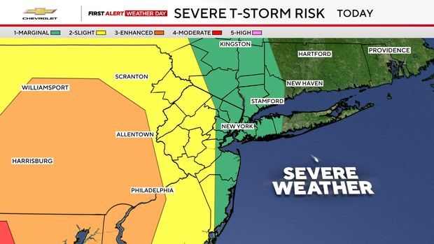
Severe storms possible
After a brief lull in activity during the mid-morning hours, rain and thunderstorms fill back in for the afternoon and evening hours.
A squall line of storms then barrels through between 8-11 p.m. Some of the storms are likely to become severe, containing damaging winds and torrential downpours.
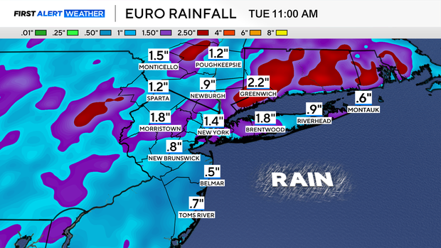
Flash flooding is definitely a concern, given that 1-2 inches of rain may fall. Locally higher amounts are possible as well.
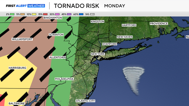
Slim tornado risk
Although not very high, there is also a slim chance of tornadoes developing. This would mainly be for locations well to the west of the city.
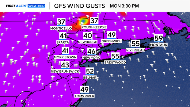
Outside of strong winds contained within individual thunderstorms, high winds are anticipated throughout the day on Monday and could be damaging. Wind gusts could approach or exceed 60 mph, especially at the coast. This may contribute to coastal flooding along Long Island's South Shore as strong southerly winds pile water onshore.
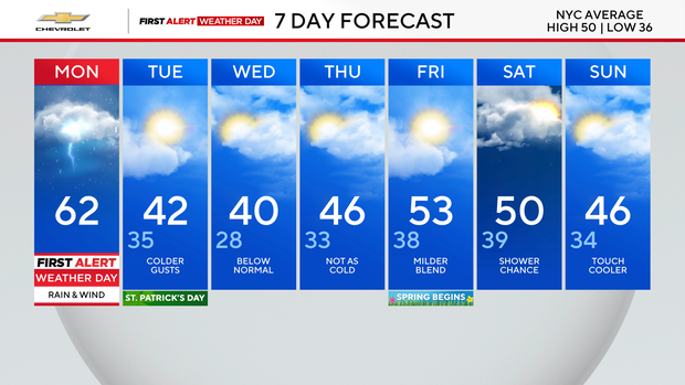
Highs on Monday will be very mild, topping out in the low to mid 60s, but as the cold front eventually passes through on Monday night, the rain could end as a period of light snow.
That sets us up for a cold and blustery St. Patrick's Day in which highs will only reach the low 40s.