Severe storms threat with large hail possible in Chicago on Thursday; ground stop at O'Hare Airport


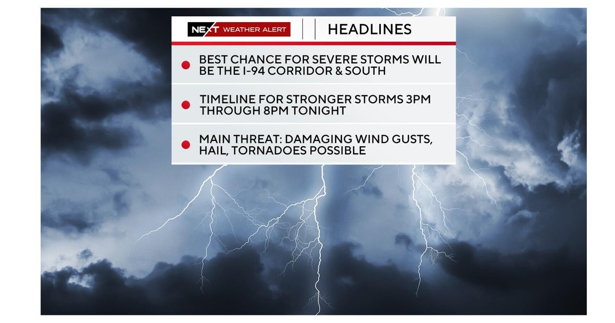
The Chicago weather threat Thursday includes the possibility of severe storms bringing very large hail, damaging winds, and a lower but not zero chance of tornadoes.
A ground stop is in effect at O'Hare International Airport as of 3:45 p.m. due to thunderstorms in the area.
A Severe Thunderstorm Watch has been issued for Ford, Grundy, Kankakee, Will, LaSalle, Livingston and Iroquois counties in Illinois and Jasper, Benton, Lake, Newtown and Porter counties in Indiana until 11 p.m.
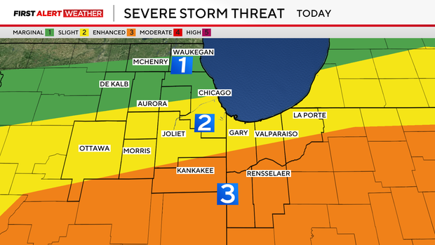
The greatest severe storm risk south of I-80. Large hail and damaging winds are the main concerns, with egg-size hail possible from Chicago southward.
The National Weather Service predicts the biggest threat for severe storms is between 3 p.m. and midnight Thursday. The tornado threat now appears lower as the accelerating cold front cuts off heat and moisture through the afternoon, but an isolated tornado is still possible from Kankakee County into Northwest Indiana through 7 p.m.
The NWS said the storm could produce hail over 2 inches in diameter, and winds could reach 60 miles per hour.
There is also the possibility for heavy downpours, with as much as one and a half inches of rain falling, which could cause flooding issues, especially in low-lying areas and on roads.
Behind the front this evening, temperatures drop steadily with strong north winds gusting over 40 mph. Storms exit the area by midnight.
By midday, some storms had already started moving through the south and southwest suburbs. One CBS News Chicago viewer in Joliet reported some small hail falling from a thunderstorm that came through around 11:45 a.m.