Flash flooding, storms expected to return to NYC, New Jersey on Friday
Thursday's flood warnings have been canceled for New York City and New Jersey, but storms are expected to return Friday.
A Flood Watch remains in effect until 11:59 p.m. Thursday for Ocean County, New Jersey.
Friday is a First Alert Weather Day for scattered flash flooding and isolated severe thunderstorms across the region.
Communities in both states have been on edge about the severe weather threat, which comes days after storms inundated neighborhoods and even caused the roof of a BJ's Wholesale Club to collapse in Ocean Township, New Jersey.
Check the latest severe weather warnings, watches and alerts
Rainfall totals
Some of Thursday's highest rainfall totals so far were recorded in New Jersey, where there were also storm damage reports.
Here's how much rain fell in different parts of the area:
- Kendall Park, NJ -- 4.91 inches
- Keansburg, NJ -- 4.35 inches
- Dayton, NJ -- 4.12 inches
- Skillman, NJ -- 3.44 inches
- JFK Airport -- 0.11 inches
Severe weather forecast
Storms are ending for Thursday night, but it remains humid and warm with temperatures in the 70s.
Friday will also be very warm and humid. The actual high will be 88, but it will feel more like 93-95.
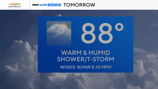
There is a 70% chance of storms developing after 4 p.m. with localized flash flooding possible, similar to Thursday's conditions.
Looking ahead
The weekend is looking like a treat.
There will be sun and clouds on Saturday, with highs in the low 80s, and Sunday will be mostly sunny. Highs again will be in the low 80s.
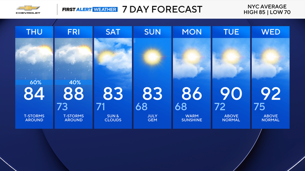
The region may experience its second heat wave of the summer in the middle of the week with temperatures over 90 degrees possible.


