Strong winds expected around NYC overnight. Get the First Alert Weather Day forecast.
NEW YORK — Heavy rain and strong winds rolled into New York on Wednesday, prompting a First Alert Weather Day.
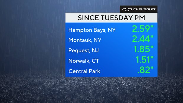
Rainfall totals in New York, New Jersey
It's been quite a wet day across the region. So far, there haven't been any reports of flooding, but there have been a few reports of downed trees, mainly across Long Island.
Rainfall amounts of well over 2 inches have already been observed in some locations, and an additional .5-1.5 inches is possible through midnight. Minor flooding may also occur. On the bright side, these copious amounts of rain will help chip away at the drought.
A flood watch is in effect for all of Connecticut through 1 a.m. Thursday.
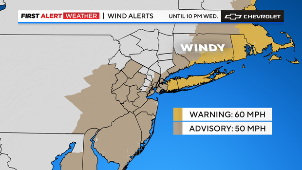
Potential damaging winds expected throughout night
Of greater concern are the strong winds that are anticipated through the night. Gusts could reach up to 60 mph or greater for eastern Long Island, while the rest of the area could see gusts up to 50 mph.
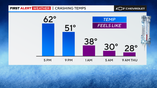
Even though all of the wind advisories technically expired at 10 p.m., gusts of these magnitudes can still happen through Thursday morning. Besides the potential damage they may cause, those prolific winds will crash temperatures from the 50s and 60s this evening into the 20s and 30s by Thursday morning. As a result, windchills will be bitter, in the teens and 20s.
Storm timeline for New York, New Jersey
7 p.m. Wednesday - 3 a.m. Thursday: The line races across Long Island hammering to the east end before heading to sea. Rainfall continues to fall across much of the area, and now with the front behind us, temperatures start their drop. We could see some snow well north and west by this time, with minor snow accumulations possible, and the winds shift west and lower. We're still talking gusts over 35 mph which will drive the feels-like temperature down into the 20s to start Thursday. Wind: 25-40 mph. Rainfall: 2-3, 4+ inches possible.
Looking ahead
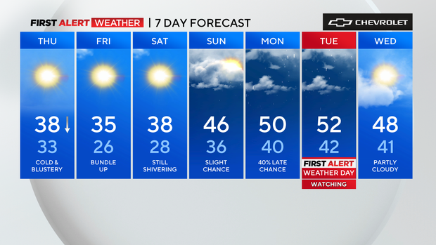
Despite decent amounts of sunshine, highs on Thursday won't get out of the 30s, meanwhile it will feel like the 20s due to ongoing gusty winds that may gust up to 40 mph at times. A stray flurry is even possible for northwestern locations. Cold temperatures will last through Saturday.
Stick with our First Alert Weather team for the latest forecast, live radar and weather alerts.