First Alert Weather: Red Alert Wednesday as extreme heat continues
Alerts: Red Alert for today and tomorrow for feels like temps around 100. There's also a chance of thunderstorms tomorrow, some of which could be strong or even severe.
Red Alerts have also been issued for Saturday and Sunday due to high heat and humidity.
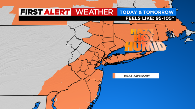
Advisories: Heat advisories in effect from 12 - 8 PM today and tomorrow across much of the tri-state area. Heat indices will range from 95-105 degrees.
Air quality alert in effect from 11 AM - 11 PM today across the city, nearby suburbs and Long Island.
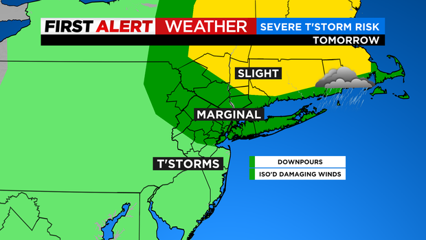
Forecast: Today will be hot and even more humid with feels like temps in the upper 90s to around 100. Tonight will be warm and stuffy with temps only falling into the upper 70s with 70s and 60s across our suburbs. As for tomorrow, it will feel like 100+ degrees with strong thunderstorms possible in the afternoon. At this point it looks like the main threats will be downpours (localized flooding) and isolated damaging wind gusts, but even an isolated tornado can't be ruled out.
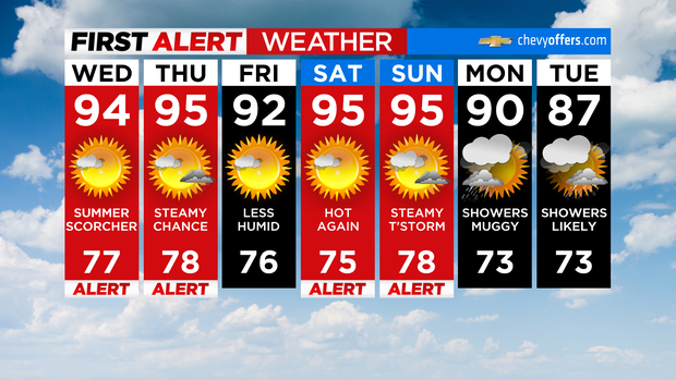
Looking Ahead: The humidity will fall off slightly on Friday, but it will remain hot. Expect highs in the low 90s. As for the weekend, it will be hot and humid with highs in the mid 90s and feels like temperatures in the mid 90s to near 100.