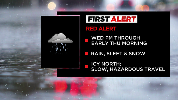
First Alert Weather: Red Alert for wintry mix of rain, snow Wednesday into Thursday
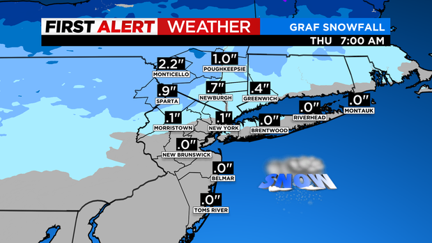
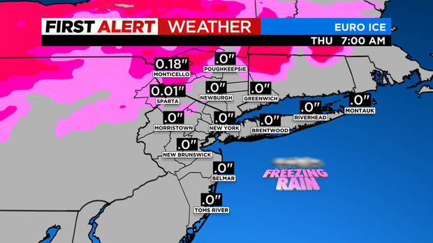
Alerts: Red Alert this afternoon through early tomorrow morning for a wintry mix and rain with the biggest impact N&W due to some icing.
Note: If model trends continue, we may downgrade to a Yellow Alert for tomorrow morning.
Forecast: Today starts dry with a wintry mix developing in the afternoon. Expect highs in the 40s.
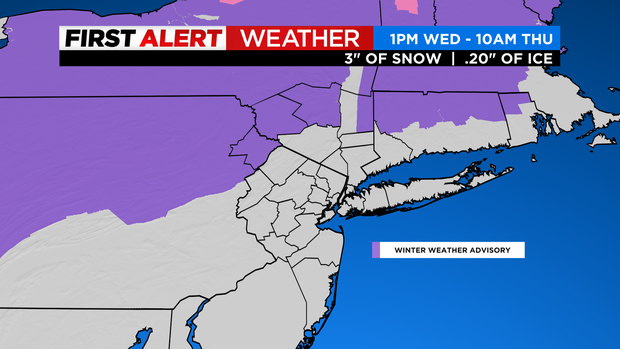
Tonight we'll see some rain/drizzle around the city with the wintery mix changing to plain rain across our northern suburbs; some frozen precipitation may linger well north.
As for tomorrow, expect some leftover rain/drizzle early with generally improving conditions through the day. It will be milder, too, with highs around 50.
Looking Ahead: Friday will be mostly sunny, cold and gusty with wind chills in the 30s. Saturday will be cold with a chance of flurries in the afternoon.
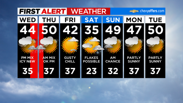
As for Sunday, there will be a leftover chance of precipitation in the morning with highs in the upper 40s.