First Alert Forecast: Temps Hang In 30s, Snow Tapers Off; Colder And Brisk Monday
By Matt DeLucia, CBS2 Meteorologist/Weather Producer
And just like that, yesterday's spring-like warmth is gone. Temps dropped, snow moved in overnight as expected, and now we're looking at a winter wonderland out there.
The good news is that much of the accumulation will continue to be on non-paved surfaces, but watch out for slick spots on the secondary roadways.
Temps won't budge much today, hanging in the low to mid 30s this afternoon. Wind chills won't be too harsh, mainly in the mid and upper 20s. Light to moderate snow will gradually taper off to flurries through the afternoon from west to east. A general 1-3 inches can be expected.
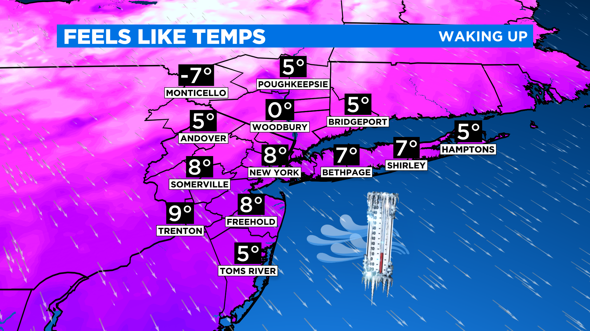
Skies gradually clear overnight and it gets much colder. We'll be in the teens waking up Monday morning, feeling more like the single digits (and even sub-zero farther north and west).

For Valentine's Day tomorrow, it's much brighter but we're stuck in the freezer all day. A brisk northwest wind will keep temps in the 20s, feeling like the teens at best.
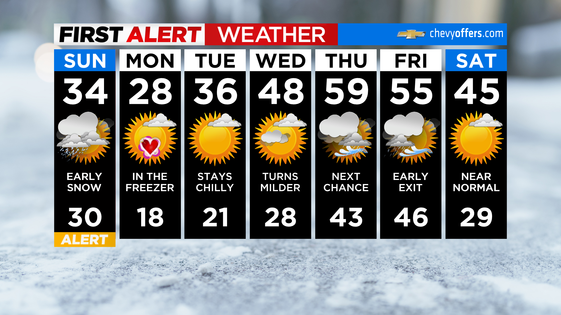
After that, we climb back above normal by midweek. Our next risk of any precipitation (in the form of rain) is Thursday.
It's a very minor snow today, so enjoy the pretty views!