First Alert Forecast: Warm and comfortable, highs in 80s Sunday, a touch warmer Monday
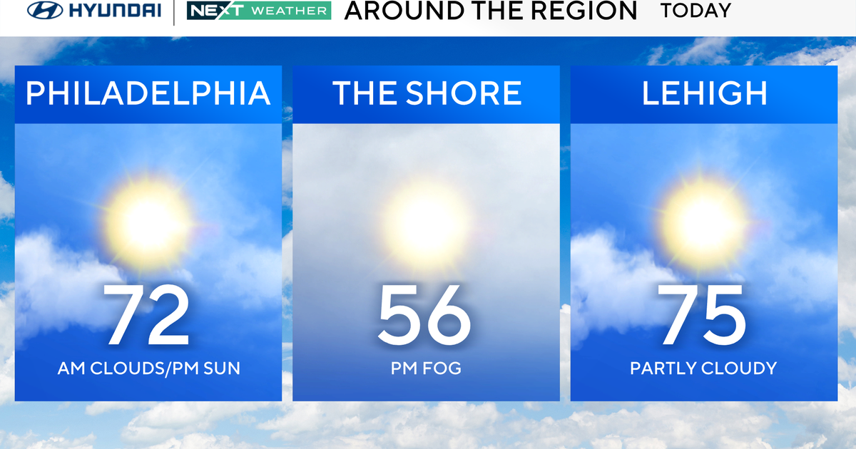
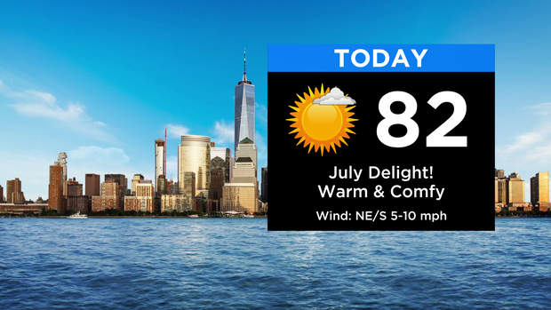
Wherever you're headed today - city, beach, mountains - you're in great shape! Expect plenty of sunshine this afternoon with highs in the low to mid 80s. Dew points are extremely low today by July standards, making it feel very comfortable.
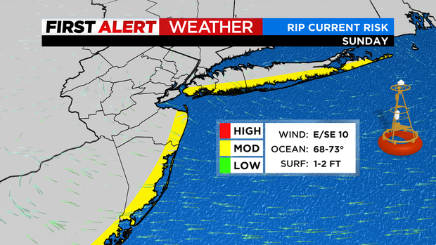
Once again, there is a moderate risk of rip currents along our ocean-facing beaches, so be sure to use caution if venturing into the water. Otherwise, it'll be a nice beach day with slightly cooler temps off the ocean topping out in the upper 70s.
Tonight will be another mostly clear and cool night with lows ranging from the upper 50s to upper 60s. That sets us up for another very nice day tomorrow, although it will be a touch warmer ... mid to upper 80s. The humidity will also stay in check for one more day.
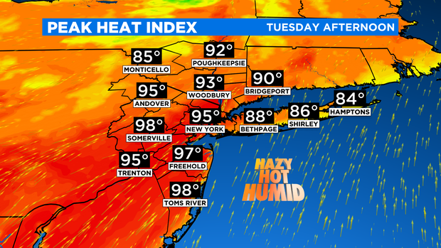
Changes move in for Tuesday in the form of heat and storms. Temps will climb into the low 90s and, with increased humidity, heat indices will soar into the mid to upper 90s.
Our next chance of showers and thunderstorms moves in for the afternoon and evening. Early heads up ... a couple storms may be strong to severe. But no issues for the next two days.

Enjoy the rest of your weekend!