Record cold possible in New York City area with arctic chill. Here's the First Alert Forecast.
Dangerously cold wind chills are forecast to hit the New York City area.
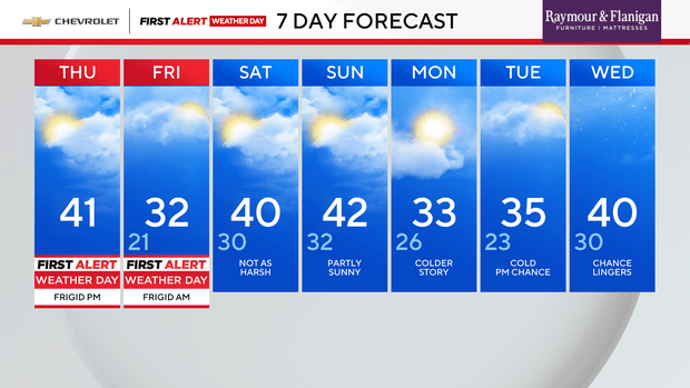
A First Alert Weather Day has been declared for Friday as the arctic chill could bring record cold temperatures to the Tri-State Area.

Friday morning is forecast to be the coldest of the season so far. Bitterly cold temperatures will feel like the teens and single digits.
Chance for record cold
Friday is going to be downright frigid as temperatures stay below freezing, and could even set records as they hover around the low 20s, teens and single digits.
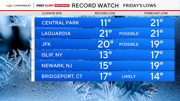
- Central Park's forecast low Friday is 21 degrees, above the record of 11 degrees.
- LaGuardia Airport's forecast low is 21 degrees, the same as the record.
- Kennedy Airport's forecast low is 19 degrees, a tick below its record of 20 degrees.
- Islip's forecast low is 17 degrees, slightly higher than its record of 13 degrees.
- Newark's forecast low is 19 degrees, above its record of 15 degrees.
- Bridgeport's forecast low is 14 degrees, which would break its record of 17 degrees.
Highs Friday are forecast in the low 30s.
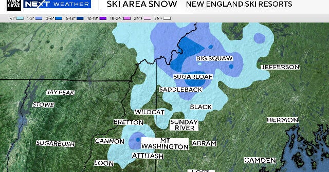
There is another snow chance in the afternoon south and east of New York City.
Saturday will feature partly sunny skies with a leftover chance of rain/snow showers east of the city. Highs will be right around 40 degrees.
Sunday will also be partly sunny with highs in the low 40s.