Rain, isolated thunderstorm linger across North Texas Wednesday and Thursday before area dries out


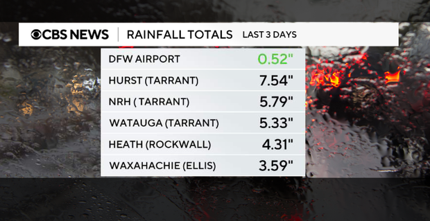
Some areas have seen a Lot of rain in the past few days. We are monitoring several creeks, streams and other waterways that potentially are nearing or overflowing their banks.
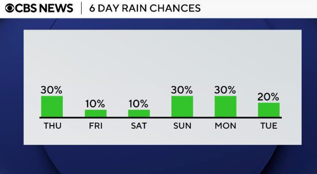
We are also monitoring another chance of scattered showers and storms on Thursday.
Isolated showers Wednesday evening
As the morning disturbance lifts into Oklahoma, sinking air behind it should suppress a lot of afternoon storm development across North Texas. That said, we can't rule out a few isolated showers or thunderstorms, especially east of I-35 and into Northeast Texas, but widespread activity is becoming less likely.
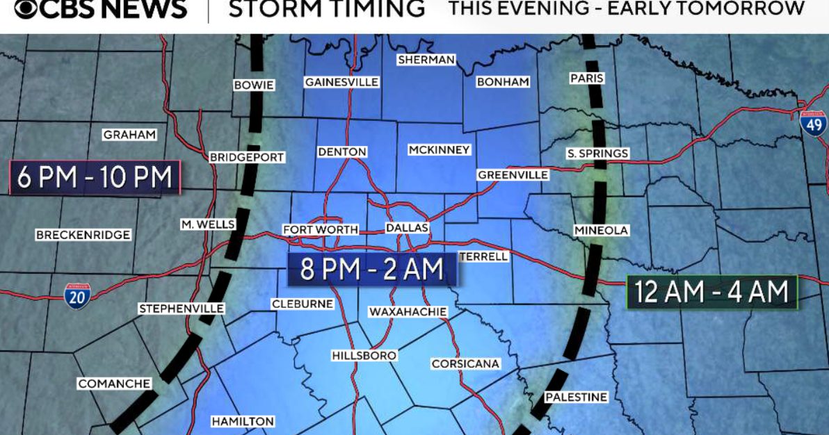
Wednesday will be a quieter night overall, though a low chance for isolated showers or storms remains, mainly along and north of the US-380 corridor. The flood threat will be low but not zero, where isolated storms develop.
Storm chances tick back up on Thursday
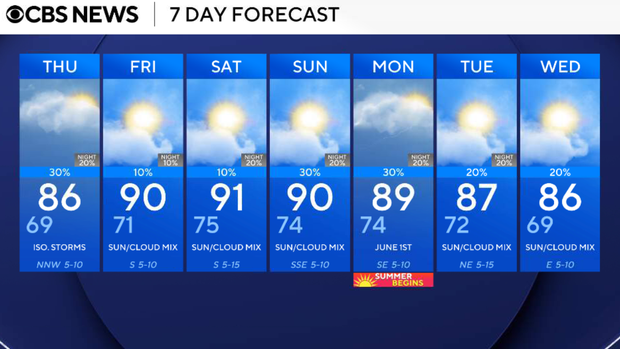
Scattered showers and thunderstorms will be possible on Thuurday, especially during the afternoon and evening, with the greatest chance north of I-20 and east of I-35. Coverage won't be widespread, but any storm could again produce gusty winds, small hail, frequent lightning and localized flash flooding. Highs will remain seasonably mild, generally in the 80s.
Rain chances drop on Friday and Saturday
A relative lull. Rain chances drop below 30% for most locations, and we'll warm back into the upper 80s to near 90 with continued humidity. A stray shower or storm can't be ruled out, especially near the Red River, but most locations stay dry.
Sunday into next week
The active pattern returns. Storm chances increase again on Sunday and continue into next week as upper-level ridging shifts east and a more unsettled southwest flow develops. Confidence remains low on exact timing and placement this far out, but daily rain and thunderstorm chances look increasingly likely.