Snow in late May? "Omega Block" will bring winter weather to mountains of northern New England.
You've probably heard the news by now; more rain and cool temperatures are expected in Boston for at least part of the upcoming weekend. Now there's one more four-letter word to the weather forecast, particularly for those living or headed to the northern mountains: Snow.
You read that right, snow is in the forecast for parts of New England as we near the end of May and start of June.
What on Earth is going on?
What is an Omega Block?
Well, starting later this week, the jetstream is going to get all sorts of funky and bent out of shape.
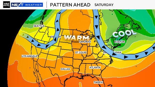
It is going to form into something we call an "Omega Block" over the United States (named for the resemblance to the Greek letter for Omega).
There will be a huge ridge of high pressure extending from the Midwest way up into Canada. This will bring record heat to areas up near Hudson Bay with temperatures expected to top 80 degrees. Consider that average temperatures this time of year on the shores of the bay typically hover in the 40s and 50s with some ice still thawing.
Conversely, major troughs in the jetstream will form on either side of that giant ridge, one in the Pacific Northwest and another right over New England.
During Friday, a rather unusual storm system will rotate from northern Canada (near Hudson Bay) right through New England, bringing with it, some very chilly air.
New England weekend weather forecast
For most of our area, this will mean a cool, rainy Friday night and Saturday. But, for elevated areas in northern New Hampshire and northern Maine, it will be back to winter.
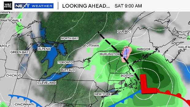
Atmospheric temperatures will be cold enough to produce snow well above our heads, down through about 4,000 to 5,000 feet. Below that, air temperatures will be above freezing, melting the snow to a plain old rainfall.
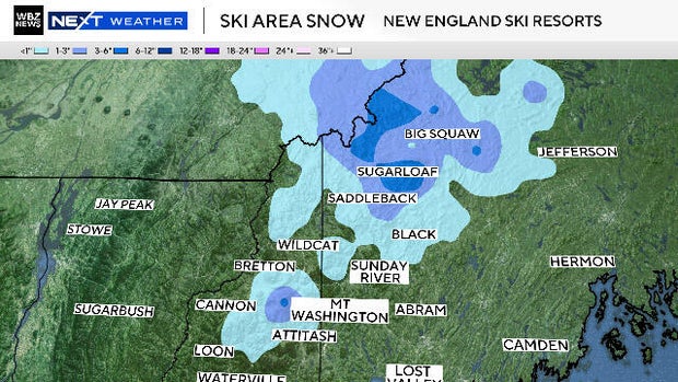
So, any mountain tops above 4,000 feet in New Hampshire and Maine, will be well within the "snow zone" Friday night through early Saturday.
This would include Sugarloaf in northwestern Maine as well as the highest peaks in the White Mountains like Mount Washington.
Snowfall amounts will generally range from 1-3" with some localized amounts up to 3-6".
Believe it or not, this is not all that unusual for Mount Washington. In fact, they average more than a foot of snow in the month of May each year and a little more than an inch in June. Currently the snow depth reads 0.0" atop the mountain, but they have officially measured 8.5" this month.