Mild Saturday before cold front brings lots of wind and possible heavy snow Sunday


Saturday will see temperatures in the 40s before a major drop off comes on Sunday.
Saturday will start with dense fog across most of the state, which will dissipate by noon. Clouds will linger all day. The dense fog returns Saturday night with a dense fog advisory put into effect from 8 p.m. Saturday and 6 a.m. Sunday.
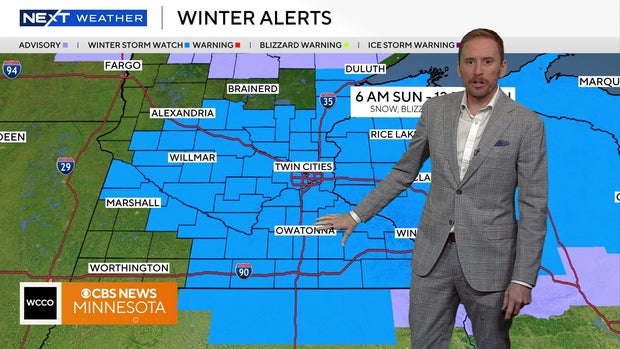
A winter storm watch will start at 6 a.m. Sunday for central and southern Minnesota. A possible WCCO Next Weather Alert could be issued for Sunday.
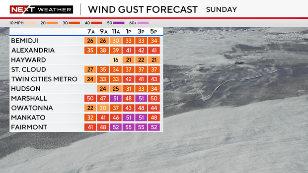
A cold front comes through on Sunday, bringing a lot of wind and the potential for heavy snow. Wind gusts could reach up to 40 mph on Sunday.
Temperatures are expected to start in the 20s before dropping off later in the day.
The worst of the conditions is expected Sunday evening with the potential for blowing snow creating blizzard-like conditions.
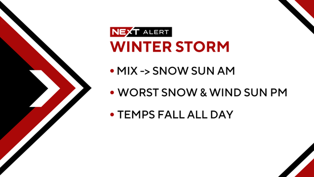
Snow will continue into Sunday night and will continue through the night before wrapping up on Monday morning.

We will start the work week with temperatures in the single digits with it feeling more like the negative teens.