Third straight #Top10WxDay before temperatures climb even more, with no relief in sight


After a chilly start, highs near 80 and plenty of sunshine will make for a third straight #Top10WxDay in the Twin Cities on Sunday.
There will be a light breeze, with gusts around 5-10 mph.
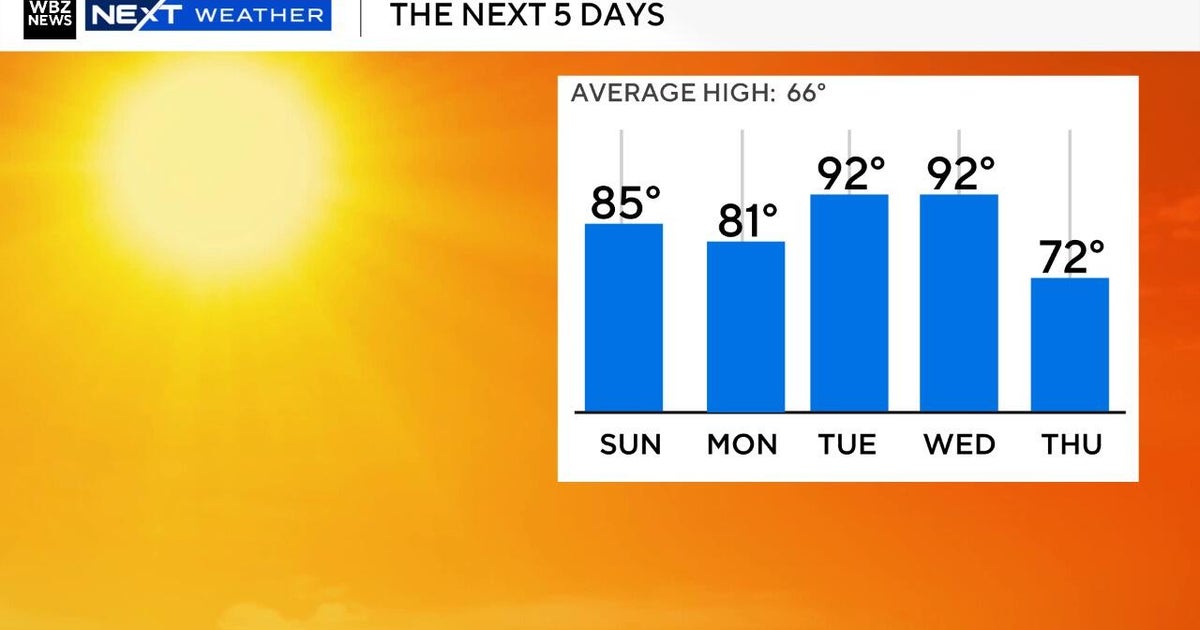
It'll drop back into the 50s overnight before the heat takes it up a notch on Monday. Southern Minnesota could see highs in the low-90s and the Twin Cities is expected to top out in the mid-80s.
High temperatures will be in the 80s all week, well above average, with the potential for record-breaking heat on Friday. For reference, the average high in the Twin Cities this time of year is around 64 degrees.
It'll be a mostly dry, sunny week, with a mix of some clouds on Tuesday and Wednesday. Dew points are expected to remain low, keeping the humidity at bay.
The temperature outlook shows highs will likely remain above average through next week as well.
The Twin Cities' next chance of rain could fall on the day of the Twin Cities Marathon.