Steady rain expected overnight, flood threat remains in Minnesota


MINNEAPOLIS — A storm system that brought strong gusts, thunderstorms, and the threat of tornadoes is moving out of Minnesota on Tuesday evening.
The worst of the storms cut through Iowa, where a twister ravaged the small town of Greenfield. Minnesota saw the northern end of the system that rolled through the Midwest. As the storm continues to push on east, Minnesota could see steady rainfall overnight, as well as some claps of thunder.
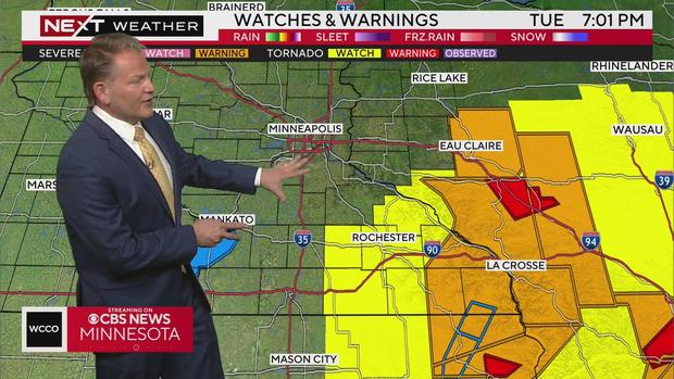
Tornado watches in southeastern Minnesota
As of early Tuesday afternoon, tornado watches were in effect across much of southeastern Minnesota and extending into Iowa. Those alerts were expected to expire at 9 p.m. The storm moved eastward through the state on Tuesday evening, and as the night went on, the National Weather Service trimmed away the watches to the west.
A confirmed tornado touched down in southeastern Minnesota between Winona and Wabasha around 6:15 p.m., though not much information about it was immediately available.
Flooding threat, thunderstorms
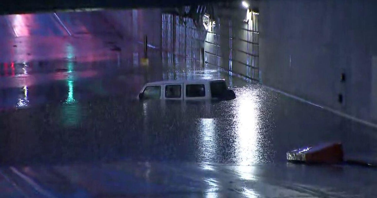
As the storm exits the state, a flash flood watch is in effect for large swaths of Minnesota until 1 a.m.
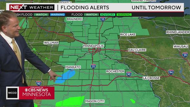
In the Mankato area, there are reports of street flooding and a flash flood warning.
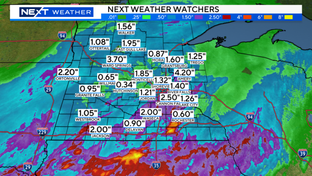
The system left behind excessive rainfall in some parts of Minnesota, exceeding three inches in areas such as Amery and Warsaw. The storm brought strong gusts, but no hail.
Storm timing
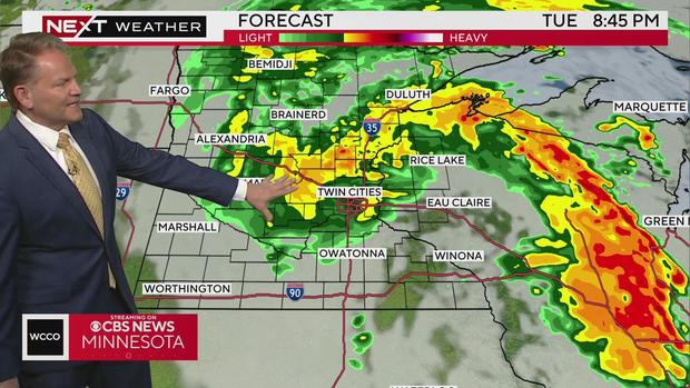
As the evening continues, WCCO NEXT Weather Meteorologists estimate that most of the severe portions of the system will push on east into Wisconsin. The rain will stick around, especially in the metro, before it clears off to the north by Wednesday morning. Some flashes of lightning are expected to strike here and there, but it won't be like the thunderstorms of the past few nights.
Wednesday should be mostly clear, aside from some rain up north.
Storms leave thousands without power
Xcel Energy reported around 24,000 customers without power on Tuesday evening, as the storm moved through southern Minnesota and the metro area. By 6:45 p.m., the outage numbers were dropping, with roughly 8,500 Xcel customers without power.
Most of the outages impacted the eastern parts of the metro area.
After-storm forecast
Wednesday should be relatively tame once this system clears. The morning may still be a bit windy, with a lingering shower or storm north and east. It will be slightly cooler in the upper 60s or near 70.
Thursday looks to be nice, with highs in the mid-70s and sunshine. It may be the lone day that doesn't have a threat for some rain.
The remainder of the week has isolated showers and storms in the forecast and highs in the 70s.
Memorial Day weekend is trending to be a mix of dry time and showers. Highs most of the weekend will be in the lower to mid-70s. There will be moments of sunshine and no concerns in the forecast for cabin or lake time.
Severe weather preparedness
In case of a tornado or thunderstorm, there are many ways to be prepared beforehand.
For tornadoes, the Red Cross advises to identify a safe place to gather in the home during a tornado, including the basement, storm cellar or interior room on the lowest floor with no windows. If you are under a tornado warning, find shelter right away. Also, stay away from windows, doors and outside walls.
If a severe thunderstorm warning is issued, take shelter in a substantial building or in a vehicle with the windows closed.
The Red Cross has many more tips to keep you safe in severe weather.