Showers, storms pass across the South Florida east coast as it heads inland

Showers and storms will develop Sunday afternoon with heavy downpours as tropical moisture still sits over South Florida and the Keys.
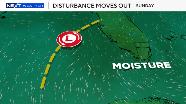
A disturbance that brought widespread rain to the area Saturday has moved into the Gulf and will continue to move away from the area Sunday and Monday.
We return to a more typical pattern for South Florida on Monday as tropical moisture moves out and a stronger southeast breeze develops. This will allow for passing showers and storms in the morning before the system moves inland in the afternoon and evening.
With less rain and more sunshine, heat and humidity will lead to heat index values pushing back above 100 degrees each afternoon. A forecast heat index of 105 degrees for two hours will lead to heat advisories being issued.
Check in each morning to see if your area is under a heat advisory so you can work around the peak heat index, which will likely occur early in the afternoon.

An area of low pressure will continue to be monitored over the next week as it moves west through the Atlantic. This area has a high chance of development now, according to the National Hurricane Center, and will likely develop into our next named storm this week.
The forecasts show this potential storm moving northwest through the Atlantic until next weekend, when the forecast trend continues to have this storm turning north before it reaches the East Coast. A lot can change before then. Stay up to date with the latest information on this potential storm's track with the NEXT Weather team.


